K33A Hardington, NE, USA - Earthquake Result Viewer
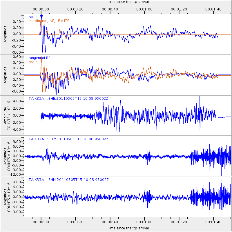
Earthquake location: Off East Coast Of Honshu, Japan
Earthquake latitude/longitude: 38.2/144.0
Earthquake time(UTC): 2011/05/05 (125) 14:58:18 GMT
Earthquake Depth: 11 km
Earthquake Magnitude: 6.2 MB, 5.7 MS, 6.1 MW, 6.1 MW
Earthquake Catalog/Contributor: WHDF/NEIC
Network: TA USArray Transportable Network (new EarthScope stations)
Station: K33A Hardington, NE, USA
Lat/Lon: 42.61 N/97.00 W
Elevation: 507 m
Distance: 82.3 deg
Az: 40.674 deg
Baz: 315.909 deg
Ray Param: 0.046952367
Estimated Moho Depth: 20.25 km
Estimated Crust Vp/Vs: 1.60
Assumed Crust Vp: 6.498 km/s
Estimated Crust Vs: 4.061 km/s
Estimated Crust Poisson's Ratio: 0.18
Radial Match: 83.29623 %
Radial Bump: 400
Transverse Match: 83.117424 %
Transverse Bump: 400
SOD ConfigId: 356183
Insert Time: 2011-10-06 15:01:36.179 +0000
GWidth: 2.5
Max Bumps: 400
Tol: 0.001

Signal To Noise

ChannelStoNSTALTA
TA:K33A: :BHZ:20110505T15:10:08.95002Z5.40912771.8070817E-63.3408008E-7
TA:K33A: :BHN:20110505T15:10:08.95002Z1.93785378.5333437E-74.4035028E-7
TA:K33A: :BHE:20110505T15:10:08.95002Z2.06778128.3744976E-74.0499924E-7
Arrivals
Ps1.9 SECOND
PpPs7.9 SECOND
PsPs/PpSs9.8 SECOND