
I34A Hadley, MN, USA - Earthquake Result Viewer
| ||||||||||||||||||
| ||||||||||||||||||
| ||||||||||||||||||
|
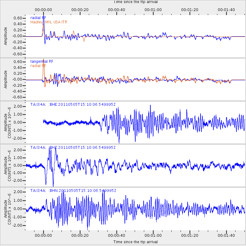
Signal To Noise
| Channel | StoN | STA | LTA |
| TA:I34A: :BHZ:20110505T15:10:06.549995Z | 9.038481 | 1.1543228E-6 | 1.2771204E-7 |
| TA:I34A: :BHN:20110505T15:10:06.549995Z | 3.5894654 | 5.2958023E-7 | 1.4753735E-7 |
| TA:I34A: :BHE:20110505T15:10:06.549995Z | 3.358453 | 4.7808595E-7 | 1.4235303E-7 |
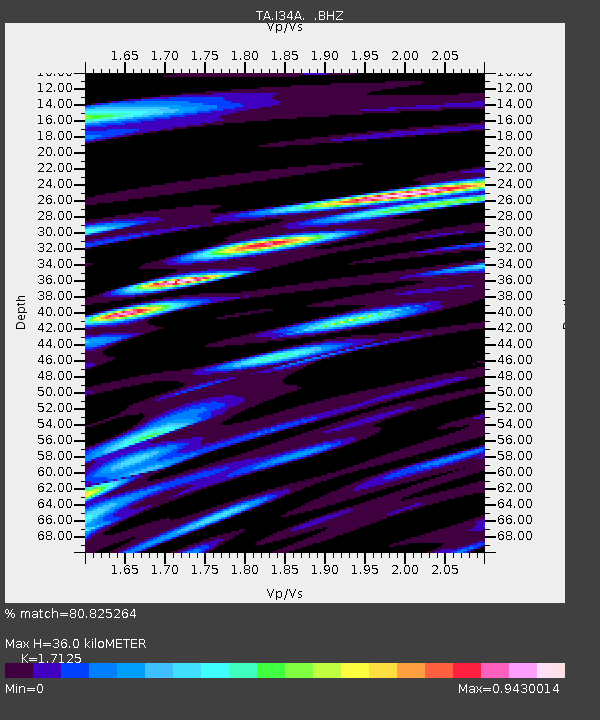
| Arrivals | |
| Ps | 4.0 SECOND |
| PpPs | 14 SECOND |
| PsPs/PpSs | 18 SECOND |

