F35A Swanville, MN, USA - Earthquake Result Viewer
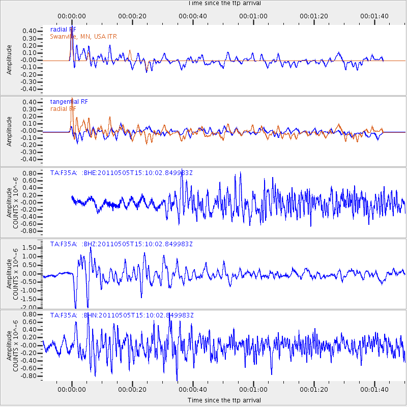
Earthquake location: Off East Coast Of Honshu, Japan
Earthquake latitude/longitude: 38.2/144.0
Earthquake time(UTC): 2011/05/05 (125) 14:58:18 GMT
Earthquake Depth: 11 km
Earthquake Magnitude: 6.2 MB, 5.7 MS, 6.1 MW, 6.1 MW
Earthquake Catalog/Contributor: WHDF/NEIC
Network: TA USArray Transportable Network (new EarthScope stations)
Station: F35A Swanville, MN, USA
Lat/Lon: 45.86 N/94.57 W
Elevation: 376 m
Distance: 81.2 deg
Az: 37.133 deg
Baz: 317.09 deg
Ray Param: 0.047763266
Estimated Moho Depth: 41.25 km
Estimated Crust Vp/Vs: 1.63
Assumed Crust Vp: 6.571 km/s
Estimated Crust Vs: 4.019 km/s
Estimated Crust Poisson's Ratio: 0.20
Radial Match: 83.53099 %
Radial Bump: 400
Transverse Match: 56.722485 %
Transverse Bump: 400
SOD ConfigId: 356183
Insert Time: 2011-10-06 15:21:25.404 +0000
GWidth: 2.5
Max Bumps: 400
Tol: 0.001

Signal To Noise

ChannelStoNSTALTA
TA:F35A: :BHZ:20110505T15:10:02.849983Z8.9415048.3168356E-79.301384E-8
TA:F35A: :BHN:20110505T15:10:02.849983Z1.7176952.599765E-71.5135195E-7
TA:F35A: :BHE:20110505T15:10:02.849983Z1.72719841.7620403E-71.0201725E-7
Arrivals
Ps4.1 SECOND
PpPs16 SECOND
PsPs/PpSs20 SECOND