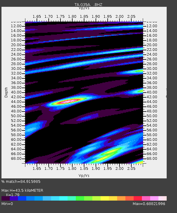
G35A Watkins, MN, USA - Earthquake Result Viewer
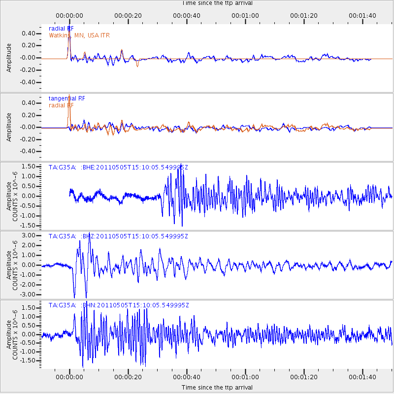
Earthquake location: Off East Coast Of Honshu, Japan
Earthquake latitude/longitude: 38.2/144.0
Earthquake time(UTC): 2011/05/05 (125) 14:58:18 GMT
Earthquake Depth: 11 km
Earthquake Magnitude: 6.2 MB, 5.7 MS, 6.1 MW, 6.1 MW
Earthquake Catalog/Contributor: WHDF/NEIC
Network: TA USArray Transportable Network (new EarthScope stations)
Station: G35A Watkins, MN, USA
Lat/Lon: 45.22 N/94.49 W
Elevation: 361 m
Distance: 81.7 deg
Az: 37.526 deg
Baz: 317.211 deg
Ray Param: 0.047404956
Estimated Moho Depth: 43.5 km
Estimated Crust Vp/Vs: 1.79
Assumed Crust Vp: 6.571 km/s
Estimated Crust Vs: 3.671 km/s
Estimated Crust Poisson's Ratio: 0.27
Radial Match: 84.915985 %
Radial Bump: 400
Transverse Match: 72.70785 %
Transverse Bump: 400
SOD ConfigId: 356183
Insert Time: 2011-10-06 15:23:36.998 +0000
GWidth: 2.5
Max Bumps: 400
Tol: 0.001

Signal To Noise

ChannelStoNSTALTA
TA:G35A: :BHZ:20110505T15:10:05.549995Z8.7754431.3293129E-61.5148099E-7
TA:G35A: :BHN:20110505T15:10:05.549995Z6.0211346.2794703E-71.04290486E-7
TA:G35A: :BHE:20110505T15:10:05.549995Z3.24723864.881652E-71.5033241E-7
Arrivals
Ps5.4 SECOND
PpPs18 SECOND
PsPs/PpSs23 SECOND