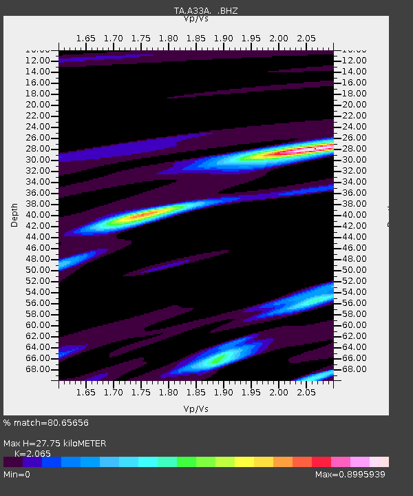
A33A Warroad, MN, USA - Earthquake Result Viewer
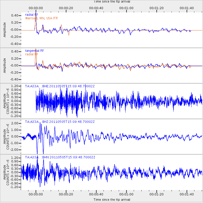
Earthquake location: Off East Coast Of Honshu, Japan
Earthquake latitude/longitude: 38.2/144.0
Earthquake time(UTC): 2011/05/05 (125) 14:58:18 GMT
Earthquake Depth: 11 km
Earthquake Magnitude: 6.2 MB, 5.7 MS, 6.1 MW, 6.1 MW
Earthquake Catalog/Contributor: WHDF/NEIC
Network: TA USArray Transportable Network (new EarthScope stations)
Station: A33A Warroad, MN, USA
Lat/Lon: 48.94 N/95.39 W
Elevation: 329 m
Distance: 78.6 deg
Az: 35.394 deg
Baz: 316.185 deg
Ray Param: 0.049554553
Estimated Moho Depth: 27.75 km
Estimated Crust Vp/Vs: 2.07
Assumed Crust Vp: 6.419 km/s
Estimated Crust Vs: 3.109 km/s
Estimated Crust Poisson's Ratio: 0.35
Radial Match: 80.65656 %
Radial Bump: 400
Transverse Match: 73.04433 %
Transverse Bump: 400
SOD ConfigId: 356183
Insert Time: 2011-10-06 15:27:03.355 +0000
GWidth: 2.5
Max Bumps: 400
Tol: 0.001

Signal To Noise

ChannelStoNSTALTA
TA:A33A: :BHZ:20110505T15:09:48.70002Z5.5847861.0723128E-61.9200607E-7
TA:A33A: :BHN:20110505T15:09:48.70002Z1.03968694.854993E-74.669668E-7
TA:A33A: :BHE:20110505T15:09:48.70002Z0.93611474.3500577E-74.646928E-7
Arrivals
Ps4.7 SECOND
PpPs13 SECOND
PsPs/PpSs18 SECOND