You are here: Home > Network List > GS - US Geological Survey Networks Stations List
> Station DEC12 Boyd Road Surface Site > Earthquake Result Viewer
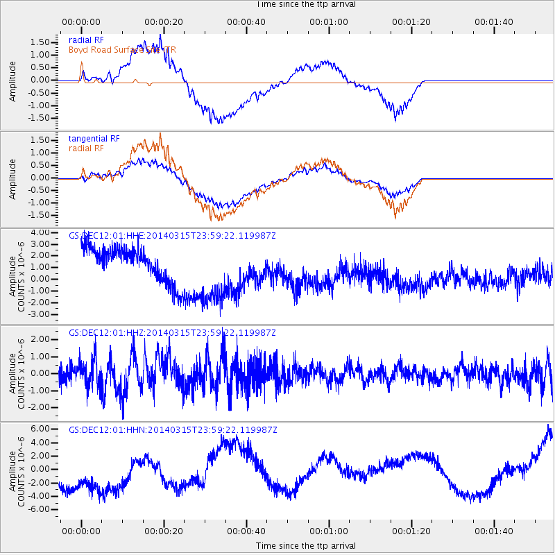
DEC12 Boyd Road Surface Site - Earthquake Result Viewer
*The percent match for this event was below the threshold and hence no stack was calculated.
| Earthquake location: |
Near Coast Of Northern Peru |
| Earthquake latitude/longitude: |
-5.6/-81.0 |
| Earthquake time(UTC): |
2014/03/15 (074) 23:51:33 GMT |
| Earthquake Depth: |
29 km |
| Earthquake Magnitude: |
6.3 MWW, 6.2 MWB, 6.3 MWC |
| Earthquake Catalog/Contributor: |
NEIC PDE/NEIC COMCAT |
|
| Network: |
GS US Geological Survey Networks |
| Station: |
DEC12 Boyd Road Surface Site |
| Lat/Lon: |
39.91 N/88.91 W |
| Elevation: |
208 m |
|
| Distance: |
45.9 deg |
| Az: |
351.473 deg |
| Baz: |
168.938 deg |
| Ray Param: |
$rayparam |
*The percent match for this event was below the threshold and hence was not used in the summary stack. |
|
| Radial Match: |
49.16688 % |
| Radial Bump: |
400 |
| Transverse Match: |
45.224316 % |
| Transverse Bump: |
400 |
| SOD ConfigId: |
3390531 |
| Insert Time: |
2019-04-10 16:41:37.820 +0000 |
| GWidth: |
2.5 |
| Max Bumps: |
400 |
| Tol: |
0.001 |
|
Signal To Noise
| Channel | StoN | STA | LTA |
| GS:DEC12:01:HHZ:20140315T23:59:22.119987Z | 1.8369807 | 8.404576E-7 | 4.575212E-7 |
| GS:DEC12:01:HHN:20140315T23:59:22.119987Z | 2.6863952 | 5.5615546E-6 | 2.0702666E-6 |
| GS:DEC12:01:HHE:20140315T23:59:22.119987Z | 2.1494389 | 2.9962014E-6 | 1.3939459E-6 |
| Arrivals |
| Ps | |
| PpPs | |
| PsPs/PpSs | |


