You are here: Home > Network List > UW - Pacific Northwest Regional Seismic Network Stations List
> Station MRBL Marblemount, WA, USA > Earthquake Result Viewer
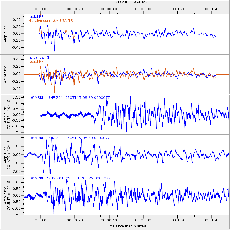
MRBL Marblemount, WA, USA - Earthquake Result Viewer
*The percent match for this event was below the threshold and hence no stack was calculated.
| Earthquake location: |
Off East Coast Of Honshu, Japan |
| Earthquake latitude/longitude: |
38.2/144.0 |
| Earthquake time(UTC): |
2011/05/05 (125) 14:58:18 GMT |
| Earthquake Depth: |
11 km |
| Earthquake Magnitude: |
6.2 MB, 5.7 MS, 6.1 MW, 6.1 MW |
| Earthquake Catalog/Contributor: |
WHDF/NEIC |
|
| Network: |
UW Pacific Northwest Regional Seismic Network |
| Station: |
MRBL Marblemount, WA, USA |
| Lat/Lon: |
48.52 N/121.48 W |
| Elevation: |
75 m |
|
| Distance: |
65.2 deg |
| Az: |
46.879 deg |
| Baz: |
300.084 deg |
| Ray Param: |
$rayparam |
*The percent match for this event was below the threshold and hence was not used in the summary stack. |
|
| Radial Match: |
74.883484 % |
| Radial Bump: |
400 |
| Transverse Match: |
70.11987 % |
| Transverse Bump: |
400 |
| SOD ConfigId: |
356183 |
| Insert Time: |
2011-10-06 16:01:48.931 +0000 |
| GWidth: |
2.5 |
| Max Bumps: |
400 |
| Tol: |
0.001 |
|
Signal To Noise
| Channel | StoN | STA | LTA |
| UW:MRBL: :BHZ:20110505T15:08:29.000007Z | 5.5558224 | 8.6687197E-7 | 1.5602947E-7 |
| UW:MRBL: :BHN:20110505T15:08:29.000007Z | 1.2955714 | 1.8889308E-7 | 1.4579905E-7 |
| UW:MRBL: :BHE:20110505T15:08:29.000007Z | 3.2490737 | 3.9947344E-7 | 1.2294994E-7 |
| Arrivals |
| Ps | |
| PpPs | |
| PsPs/PpSs | |


