You are here: Home > Network List > G - GEOSCOPE Stations List
> Station INU Inuyama, Japan > Earthquake Result Viewer
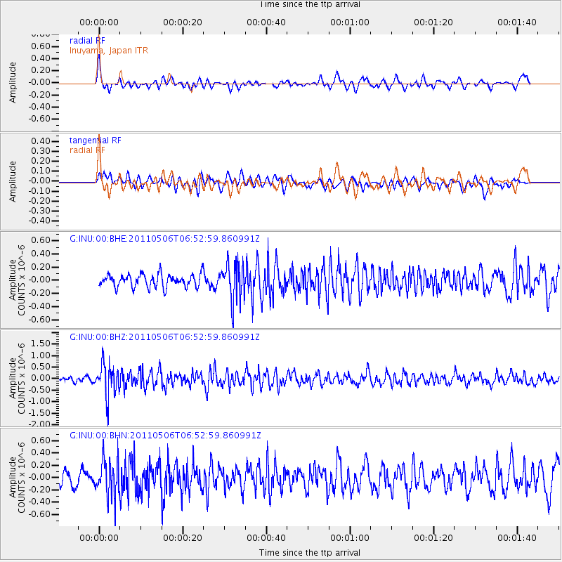
INU Inuyama, Japan - Earthquake Result Viewer
*The percent match for this event was below the threshold and hence no stack was calculated.
| Earthquake location: |
Minahassa Peninsula, Sulawesi |
| Earthquake latitude/longitude: |
-0.1/122.9 |
| Earthquake time(UTC): |
2011/05/06 (126) 06:46:23 GMT |
| Earthquake Depth: |
82 km |
| Earthquake Magnitude: |
5.8 MB, 5.5 MW, 5.5 MW |
| Earthquake Catalog/Contributor: |
WHDF/NEIC |
|
| Network: |
G GEOSCOPE |
| Station: |
INU Inuyama, Japan |
| Lat/Lon: |
35.35 N/137.03 E |
| Elevation: |
132 m |
|
| Distance: |
37.6 deg |
| Az: |
19.022 deg |
| Baz: |
203.498 deg |
| Ray Param: |
$rayparam |
*The percent match for this event was below the threshold and hence was not used in the summary stack. |
|
| Radial Match: |
66.30826 % |
| Radial Bump: |
400 |
| Transverse Match: |
47.96398 % |
| Transverse Bump: |
400 |
| SOD ConfigId: |
356183 |
| Insert Time: |
2011-10-06 16:44:24.046 +0000 |
| GWidth: |
2.5 |
| Max Bumps: |
400 |
| Tol: |
0.001 |
|
Signal To Noise
| Channel | StoN | STA | LTA |
| G:INU:00:BHZ:20110506T06:52:59.860991Z | 6.4097576 | 6.9278025E-7 | 1.08082126E-7 |
| G:INU:00:BHN:20110506T06:52:59.860991Z | 2.75409 | 3.0761547E-7 | 1.1169404E-7 |
| G:INU:00:BHE:20110506T06:52:59.860991Z | 3.0369716 | 2.9116373E-7 | 9.5873055E-8 |
| Arrivals |
| Ps | |
| PpPs | |
| PsPs/PpSs | |


