You are here: Home > Network List > TA - USArray Transportable Network (new EarthScope stations) Stations List
> Station D49A Beulah Township, ON, CAN > Earthquake Result Viewer
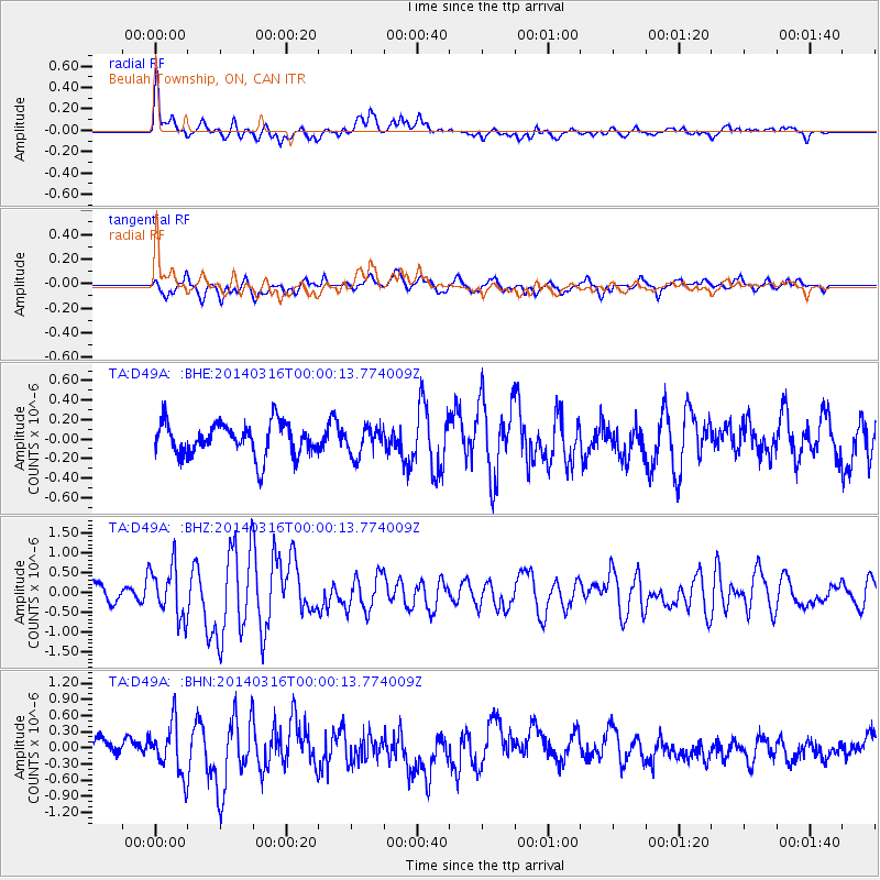
D49A Beulah Township, ON, CAN - Earthquake Result Viewer
*The percent match for this event was below the threshold and hence no stack was calculated.
| Earthquake location: |
Near Coast Of Northern Peru |
| Earthquake latitude/longitude: |
-5.6/-81.0 |
| Earthquake time(UTC): |
2014/03/15 (074) 23:51:33 GMT |
| Earthquake Depth: |
29 km |
| Earthquake Magnitude: |
6.3 MWW, 6.2 MWB, 6.3 MWC |
| Earthquake Catalog/Contributor: |
NEIC PDE/NEIC COMCAT |
|
| Network: |
TA USArray Transportable Network (new EarthScope stations) |
| Station: |
D49A Beulah Township, ON, CAN |
| Lat/Lon: |
47.27 N/81.36 W |
| Elevation: |
416 m |
|
| Distance: |
52.6 deg |
| Az: |
359.657 deg |
| Baz: |
179.499 deg |
| Ray Param: |
$rayparam |
*The percent match for this event was below the threshold and hence was not used in the summary stack. |
|
| Radial Match: |
74.59243 % |
| Radial Bump: |
400 |
| Transverse Match: |
72.84551 % |
| Transverse Bump: |
400 |
| SOD ConfigId: |
3390531 |
| Insert Time: |
2019-04-10 16:43:17.715 +0000 |
| GWidth: |
2.5 |
| Max Bumps: |
400 |
| Tol: |
0.001 |
|
Signal To Noise
| Channel | StoN | STA | LTA |
| TA:D49A: :BHZ:20140316T00:00:13.774009Z | 3.0484228 | 6.559519E-7 | 2.1517747E-7 |
| TA:D49A: :BHN:20140316T00:00:13.774009Z | 2.283133 | 4.707081E-7 | 2.0616761E-7 |
| TA:D49A: :BHE:20140316T00:00:13.774009Z | 0.84679824 | 1.4292958E-7 | 1.6878823E-7 |
| Arrivals |
| Ps | |
| PpPs | |
| PsPs/PpSs | |


