You are here: Home > Network List > KN - Kyrgyz Seismic Telemetry Network Stations List
> Station CHM KN.CHM > Earthquake Result Viewer
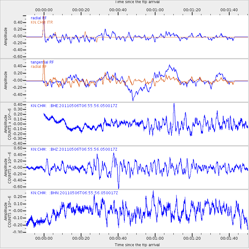
CHM KN.CHM - Earthquake Result Viewer
*The percent match for this event was below the threshold and hence no stack was calculated.
| Earthquake location: |
Minahassa Peninsula, Sulawesi |
| Earthquake latitude/longitude: |
-0.1/122.9 |
| Earthquake time(UTC): |
2011/05/06 (126) 06:46:23 GMT |
| Earthquake Depth: |
82 km |
| Earthquake Magnitude: |
5.8 MB, 5.5 MW, 5.5 MW |
| Earthquake Catalog/Contributor: |
WHDF/NEIC |
|
| Network: |
KN Kyrgyz Seismic Telemetry Network |
| Station: |
CHM KN.CHM |
| Lat/Lon: |
43.00 N/74.75 E |
| Elevation: |
655 m |
|
| Distance: |
60.8 deg |
| Az: |
321.195 deg |
| Baz: |
121.331 deg |
| Ray Param: |
$rayparam |
*The percent match for this event was below the threshold and hence was not used in the summary stack. |
|
| Radial Match: |
72.11673 % |
| Radial Bump: |
400 |
| Transverse Match: |
23.193386 % |
| Transverse Bump: |
400 |
| SOD ConfigId: |
356183 |
| Insert Time: |
2011-10-06 16:50:15.329 +0000 |
| GWidth: |
2.5 |
| Max Bumps: |
400 |
| Tol: |
0.001 |
|
Signal To Noise
| Channel | StoN | STA | LTA |
| KN:CHM: :BHZ:20110506T06:55:56.050017Z | 3.0651898 | 1.290947E-7 | 4.2116383E-8 |
| KN:CHM: :BHN:20110506T06:55:56.050017Z | 0.9769543 | 2.2183055E-7 | 2.2706338E-7 |
| KN:CHM: :BHE:20110506T06:55:56.050017Z | 0.68877226 | 6.6868616E-8 | 9.708377E-8 |
| Arrivals |
| Ps | |
| PpPs | |
| PsPs/PpSs | |


