You are here: Home > Network List > KN - Kyrgyz Seismic Telemetry Network Stations List
> Station TKM2 KN.TKM2 > Earthquake Result Viewer
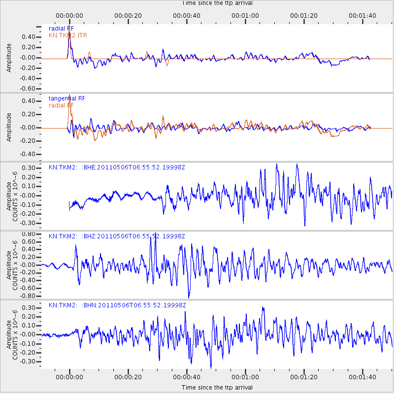
TKM2 KN.TKM2 - Earthquake Result Viewer
*The percent match for this event was below the threshold and hence no stack was calculated.
| Earthquake location: |
Minahassa Peninsula, Sulawesi |
| Earthquake latitude/longitude: |
-0.1/122.9 |
| Earthquake time(UTC): |
2011/05/06 (126) 06:46:23 GMT |
| Earthquake Depth: |
82 km |
| Earthquake Magnitude: |
5.8 MB, 5.5 MW, 5.5 MW |
| Earthquake Catalog/Contributor: |
WHDF/NEIC |
|
| Network: |
KN Kyrgyz Seismic Telemetry Network |
| Station: |
TKM2 KN.TKM2 |
| Lat/Lon: |
42.92 N/75.60 E |
| Elevation: |
2020 m |
|
| Distance: |
60.2 deg |
| Az: |
321.494 deg |
| Baz: |
122.052 deg |
| Ray Param: |
$rayparam |
*The percent match for this event was below the threshold and hence was not used in the summary stack. |
|
| Radial Match: |
60.75446 % |
| Radial Bump: |
400 |
| Transverse Match: |
71.049866 % |
| Transverse Bump: |
400 |
| SOD ConfigId: |
356183 |
| Insert Time: |
2011-10-06 16:53:23.061 +0000 |
| GWidth: |
2.5 |
| Max Bumps: |
400 |
| Tol: |
0.001 |
|
Signal To Noise
| Channel | StoN | STA | LTA |
| KN:TKM2: :BHZ:20110506T06:55:52.19998Z | 5.2513714 | 2.1920438E-7 | 4.174231E-8 |
| KN:TKM2: :BHN:20110506T06:55:52.19998Z | 1.6193913 | 4.4772175E-8 | 2.7647534E-8 |
| KN:TKM2: :BHE:20110506T06:55:52.19998Z | 1.4072828 | 6.6562116E-8 | 4.729832E-8 |
| Arrivals |
| Ps | |
| PpPs | |
| PsPs/PpSs | |


