You are here: Home > Network List > TA - USArray Transportable Network (new EarthScope stations) Stations List
> Station H27A Howes, SD, USA > Earthquake Result Viewer
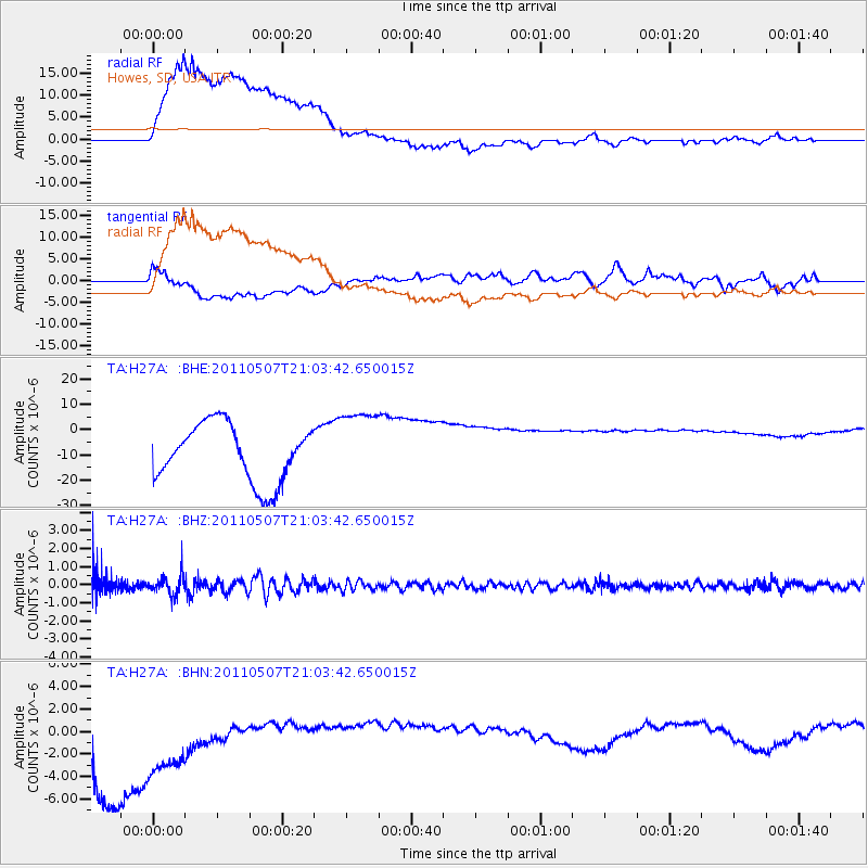
H27A Howes, SD, USA - Earthquake Result Viewer
*The percent match for this event was below the threshold and hence no stack was calculated.
| Earthquake location: |
Near East Coast Of Honshu, Japan |
| Earthquake latitude/longitude: |
40.2/142.2 |
| Earthquake time(UTC): |
2011/05/07 (127) 20:52:20 GMT |
| Earthquake Depth: |
35 km |
| Earthquake Magnitude: |
5.5 MB, 5.2 MS, 5.7 MW, 5.7 MW |
| Earthquake Catalog/Contributor: |
WHDF/NEIC |
|
| Network: |
TA USArray Transportable Network (new EarthScope stations) |
| Station: |
H27A Howes, SD, USA |
| Lat/Lon: |
44.63 N/102.08 W |
| Elevation: |
748 m |
|
| Distance: |
77.7 deg |
| Az: |
41.199 deg |
| Baz: |
315.074 deg |
| Ray Param: |
$rayparam |
*The percent match for this event was below the threshold and hence was not used in the summary stack. |
|
| Radial Match: |
71.57284 % |
| Radial Bump: |
400 |
| Transverse Match: |
20.41707 % |
| Transverse Bump: |
400 |
| SOD ConfigId: |
390285 |
| Insert Time: |
2011-10-18 05:35:31.208 +0000 |
| GWidth: |
2.5 |
| Max Bumps: |
400 |
| Tol: |
0.001 |
|
Signal To Noise
| Channel | StoN | STA | LTA |
| TA:H27A: :BHZ:20110507T21:03:42.650015Z | 0.60403174 | 5.5155283E-7 | 9.13119E-7 |
| TA:H27A: :BHN:20110507T21:03:42.650015Z | 0.1782535 | 2.2808233E-6 | 1.2795391E-5 |
| TA:H27A: :BHE:20110507T21:03:42.650015Z | 1.3321368 | 1.49485995E-5 | 1.122152E-5 |
| Arrivals |
| Ps | |
| PpPs | |
| PsPs/PpSs | |


