You are here: Home > Network List > TA - USArray Transportable Network (new EarthScope stations) Stations List
> Station S36A Lake Cedric, Chanute, KS, USA > Earthquake Result Viewer
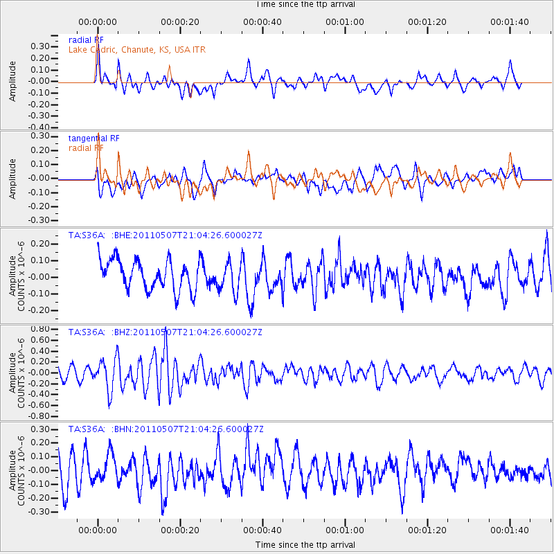
S36A Lake Cedric, Chanute, KS, USA - Earthquake Result Viewer
*The percent match for this event was below the threshold and hence no stack was calculated.
| Earthquake location: |
Near East Coast Of Honshu, Japan |
| Earthquake latitude/longitude: |
40.2/142.2 |
| Earthquake time(UTC): |
2011/05/07 (127) 20:52:20 GMT |
| Earthquake Depth: |
35 km |
| Earthquake Magnitude: |
5.5 MB, 5.2 MS, 5.7 MW, 5.7 MW |
| Earthquake Catalog/Contributor: |
WHDF/NEIC |
|
| Network: |
TA USArray Transportable Network (new EarthScope stations) |
| Station: |
S36A Lake Cedric, Chanute, KS, USA |
| Lat/Lon: |
37.72 N/95.59 W |
| Elevation: |
299 m |
|
| Distance: |
86.0 deg |
| Az: |
42.287 deg |
| Baz: |
319.492 deg |
| Ray Param: |
$rayparam |
*The percent match for this event was below the threshold and hence was not used in the summary stack. |
|
| Radial Match: |
59.01361 % |
| Radial Bump: |
400 |
| Transverse Match: |
54.44445 % |
| Transverse Bump: |
400 |
| SOD ConfigId: |
390285 |
| Insert Time: |
2011-10-18 05:43:05.364 +0000 |
| GWidth: |
2.5 |
| Max Bumps: |
400 |
| Tol: |
0.001 |
|
Signal To Noise
| Channel | StoN | STA | LTA |
| TA:S36A: :BHZ:20110507T21:04:26.600027Z | 2.935858 | 2.95768E-7 | 1.0074329E-7 |
| TA:S36A: :BHN:20110507T21:04:26.600027Z | 0.986519 | 1.0002598E-7 | 1.01392864E-7 |
| TA:S36A: :BHE:20110507T21:04:26.600027Z | 1.0160642 | 9.063429E-8 | 8.920134E-8 |
| Arrivals |
| Ps | |
| PpPs | |
| PsPs/PpSs | |


