You are here: Home > Network List > TA - USArray Transportable Network (new EarthScope stations) Stations List
> Station P38A Dawn, MO, USA > Earthquake Result Viewer
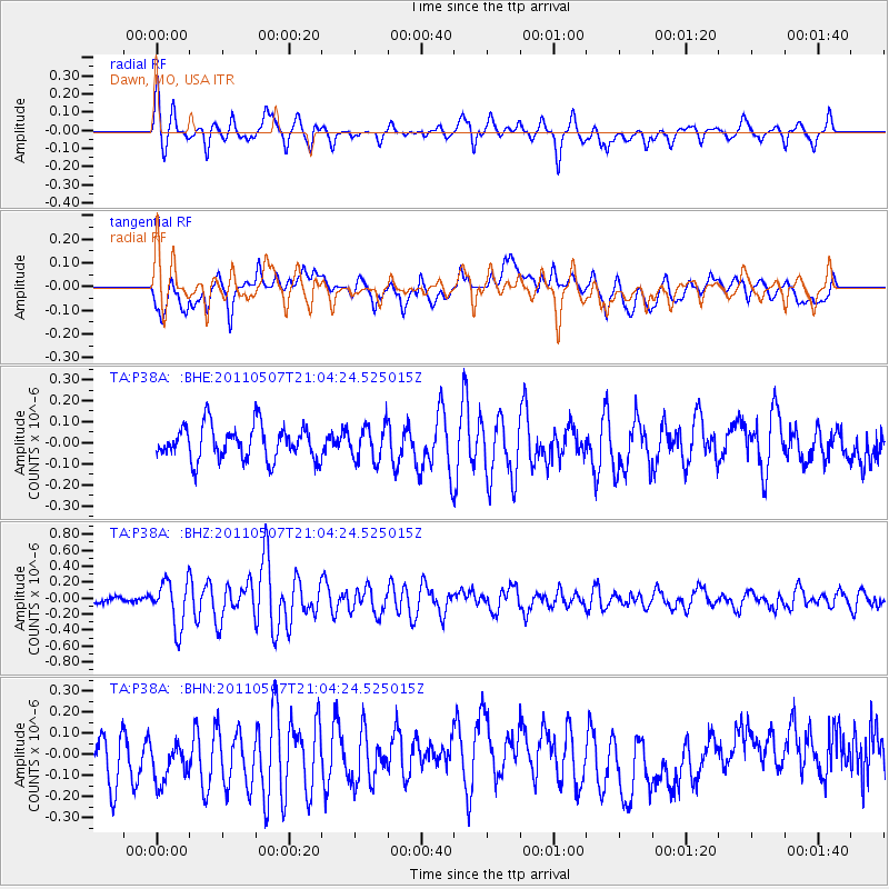
P38A Dawn, MO, USA - Earthquake Result Viewer
*The percent match for this event was below the threshold and hence no stack was calculated.
| Earthquake location: |
Near East Coast Of Honshu, Japan |
| Earthquake latitude/longitude: |
40.2/142.2 |
| Earthquake time(UTC): |
2011/05/07 (127) 20:52:20 GMT |
| Earthquake Depth: |
35 km |
| Earthquake Magnitude: |
5.5 MB, 5.2 MS, 5.7 MW, 5.7 MW |
| Earthquake Catalog/Contributor: |
WHDF/NEIC |
|
| Network: |
TA USArray Transportable Network (new EarthScope stations) |
| Station: |
P38A Dawn, MO, USA |
| Lat/Lon: |
39.62 N/93.53 W |
| Elevation: |
248 m |
|
| Distance: |
85.6 deg |
| Az: |
39.826 deg |
| Baz: |
320.596 deg |
| Ray Param: |
$rayparam |
*The percent match for this event was below the threshold and hence was not used in the summary stack. |
|
| Radial Match: |
51.874973 % |
| Radial Bump: |
400 |
| Transverse Match: |
48.672028 % |
| Transverse Bump: |
400 |
| SOD ConfigId: |
390285 |
| Insert Time: |
2011-10-18 05:52:58.137 +0000 |
| GWidth: |
2.5 |
| Max Bumps: |
400 |
| Tol: |
0.001 |
|
Signal To Noise
| Channel | StoN | STA | LTA |
| TA:P38A: :BHZ:20110507T21:04:24.525015Z | 3.528575 | 2.9000466E-7 | 8.2187476E-8 |
| TA:P38A: :BHN:20110507T21:04:24.525015Z | 1.0042572 | 1.3507064E-7 | 1.3449804E-7 |
| TA:P38A: :BHE:20110507T21:04:24.525015Z | 0.99386257 | 8.0288636E-8 | 8.0784446E-8 |
| Arrivals |
| Ps | |
| PpPs | |
| PsPs/PpSs | |


