You are here: Home > Network List > IC - New China Digital Seismograph Network Stations List
> Station ENH Enshi, Hubei Province, China > Earthquake Result Viewer
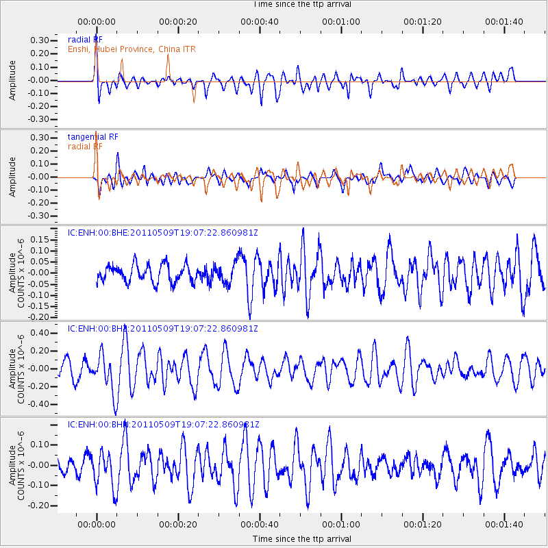
ENH Enshi, Hubei Province, China - Earthquake Result Viewer
*The percent match for this event was below the threshold and hence no stack was calculated.
| Earthquake location: |
West Of Macquarie Island |
| Earthquake latitude/longitude: |
-56.7/147.4 |
| Earthquake time(UTC): |
2011/05/09 (129) 18:54:43 GMT |
| Earthquake Depth: |
9.0 km |
| Earthquake Magnitude: |
5.7 MB, 5.7 MS, 6.1 MW, 5.9 MW |
| Earthquake Catalog/Contributor: |
WHDF/NEIC |
|
| Network: |
IC New China Digital Seismograph Network |
| Station: |
ENH Enshi, Hubei Province, China |
| Lat/Lon: |
30.28 N/109.49 E |
| Elevation: |
500 m |
|
| Distance: |
92.4 deg |
| Az: |
327.856 deg |
| Baz: |
160.141 deg |
| Ray Param: |
$rayparam |
*The percent match for this event was below the threshold and hence was not used in the summary stack. |
|
| Radial Match: |
57.403816 % |
| Radial Bump: |
400 |
| Transverse Match: |
57.370373 % |
| Transverse Bump: |
400 |
| SOD ConfigId: |
390285 |
| Insert Time: |
2011-10-18 06:03:07.399 +0000 |
| GWidth: |
2.5 |
| Max Bumps: |
400 |
| Tol: |
0.001 |
|
Signal To Noise
| Channel | StoN | STA | LTA |
| IC:ENH:00:BHZ:20110509T19:07:22.860981Z | 2.030758 | 2.2426524E-7 | 1.1043426E-7 |
| IC:ENH:00:BHN:20110509T19:07:22.860981Z | 2.1652274 | 8.921477E-8 | 4.120342E-8 |
| IC:ENH:00:BHE:20110509T19:07:22.860981Z | 1.197965 | 4.6303327E-8 | 3.8651653E-8 |
| Arrivals |
| Ps | |
| PpPs | |
| PsPs/PpSs | |


