BFS Mt Baldy Forest Station - Earthquake Result Viewer
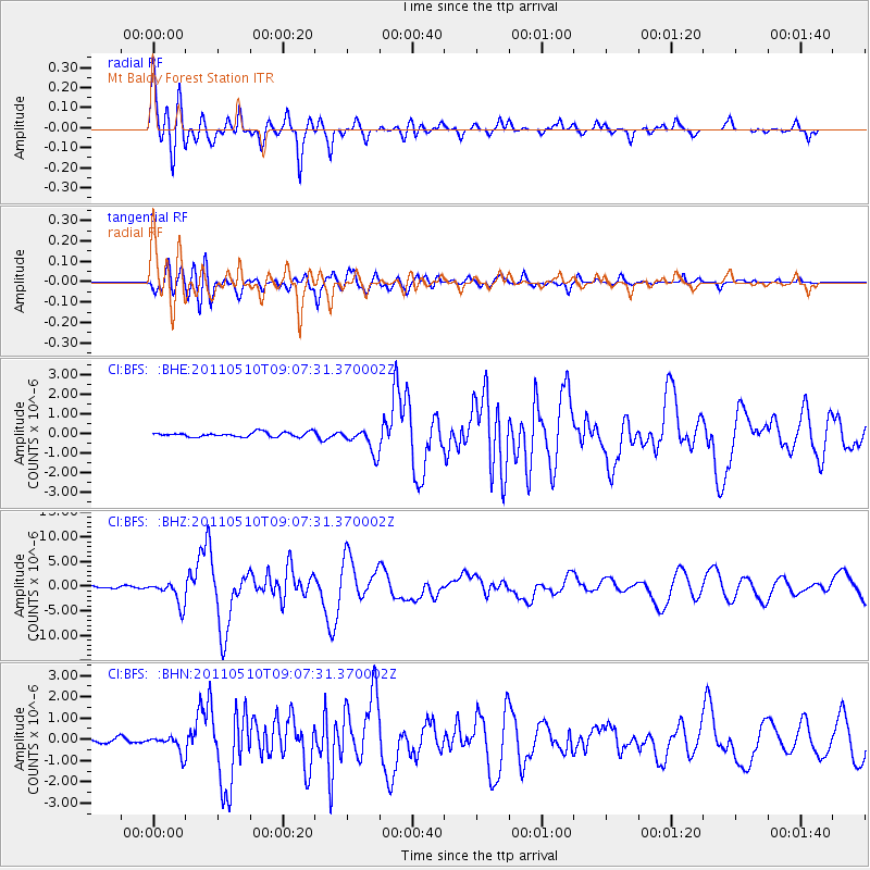
Earthquake location: Loyalty Islands
Earthquake latitude/longitude: -20.2/168.2
Earthquake time(UTC): 2011/05/10 (130) 08:55:08 GMT
Earthquake Depth: 11 km
Earthquake Magnitude: 6.4 MB, 6.8 MS, 6.9 MW, 6.8 MW
Earthquake Catalog/Contributor: WHDF/NEIC
Network: CI Caltech Regional Seismic Network
Station: BFS Mt Baldy Forest Station
Lat/Lon: 34.24 N/117.66 W
Elevation: 1312 m
Distance: 88.8 deg
Az: 52.843 deg
Baz: 244.596 deg
Ray Param: 0.04228562
Estimated Moho Depth: 45.25 km
Estimated Crust Vp/Vs: 1.60
Assumed Crust Vp: 6.276 km/s
Estimated Crust Vs: 3.922 km/s
Estimated Crust Poisson's Ratio: 0.18
Radial Match: 91.67553 %
Radial Bump: 400
Transverse Match: 86.88473 %
Transverse Bump: 400
SOD ConfigId: 390285
Insert Time: 2011-10-18 06:46:24.084 +0000
GWidth: 2.5
Max Bumps: 400
Tol: 0.001

Signal To Noise

ChannelStoNSTALTA
CI:BFS: :BHZ:20110510T09:07:31.370002Z21.7772792.374755E-61.0904736E-7
CI:BFS: :BHN:20110510T09:07:31.370002Z3.71570444.0714085E-71.09572994E-7
CI:BFS: :BHE:20110510T09:07:31.370002Z5.4496156.3106825E-71.1580052E-7
Arrivals
Ps4.4 SECOND
PpPs18 SECOND
PsPs/PpSs23 SECOND