You are here: Home > Network List > TA - USArray Transportable Network (new EarthScope stations) Stations List
> Station G05D Wamic, OR, USA > Earthquake Result Viewer
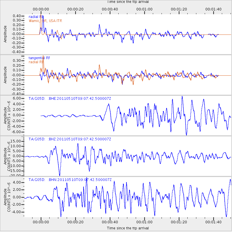
G05D Wamic, OR, USA - Earthquake Result Viewer
*The percent match for this event was below the threshold and hence no stack was calculated.
| Earthquake location: |
Loyalty Islands |
| Earthquake latitude/longitude: |
-20.2/168.2 |
| Earthquake time(UTC): |
2011/05/10 (130) 08:55:08 GMT |
| Earthquake Depth: |
11 km |
| Earthquake Magnitude: |
6.4 MB, 6.8 MS, 6.9 MW, 6.8 MW |
| Earthquake Catalog/Contributor: |
WHDF/NEIC |
|
| Network: |
TA USArray Transportable Network (new EarthScope stations) |
| Station: |
G05D Wamic, OR, USA |
| Lat/Lon: |
45.24 N/121.32 W |
| Elevation: |
592 m |
|
| Distance: |
91.2 deg |
| Az: |
41.755 deg |
| Baz: |
242.263 deg |
| Ray Param: |
$rayparam |
*The percent match for this event was below the threshold and hence was not used in the summary stack. |
|
| Radial Match: |
86.87487 % |
| Radial Bump: |
400 |
| Transverse Match: |
81.61603 % |
| Transverse Bump: |
400 |
| SOD ConfigId: |
390285 |
| Insert Time: |
2011-10-18 06:56:02.905 +0000 |
| GWidth: |
2.5 |
| Max Bumps: |
400 |
| Tol: |
0.001 |
|
Signal To Noise
| Channel | StoN | STA | LTA |
| TA:G05D: :BHZ:20110510T09:07:42.500007Z | 8.746755 | 2.6486455E-6 | 3.0281464E-7 |
| TA:G05D: :BHN:20110510T09:07:42.500007Z | 2.3707147 | 5.2065883E-7 | 2.1962103E-7 |
| TA:G05D: :BHE:20110510T09:07:42.500007Z | 0.69298065 | 1.543641E-7 | 2.2275384E-7 |
| Arrivals |
| Ps | |
| PpPs | |
| PsPs/PpSs | |


