You are here: Home > Network List > TA - USArray Transportable Network (new EarthScope stations) Stations List
> Station G03D McMinnville, OR, USA > Earthquake Result Viewer
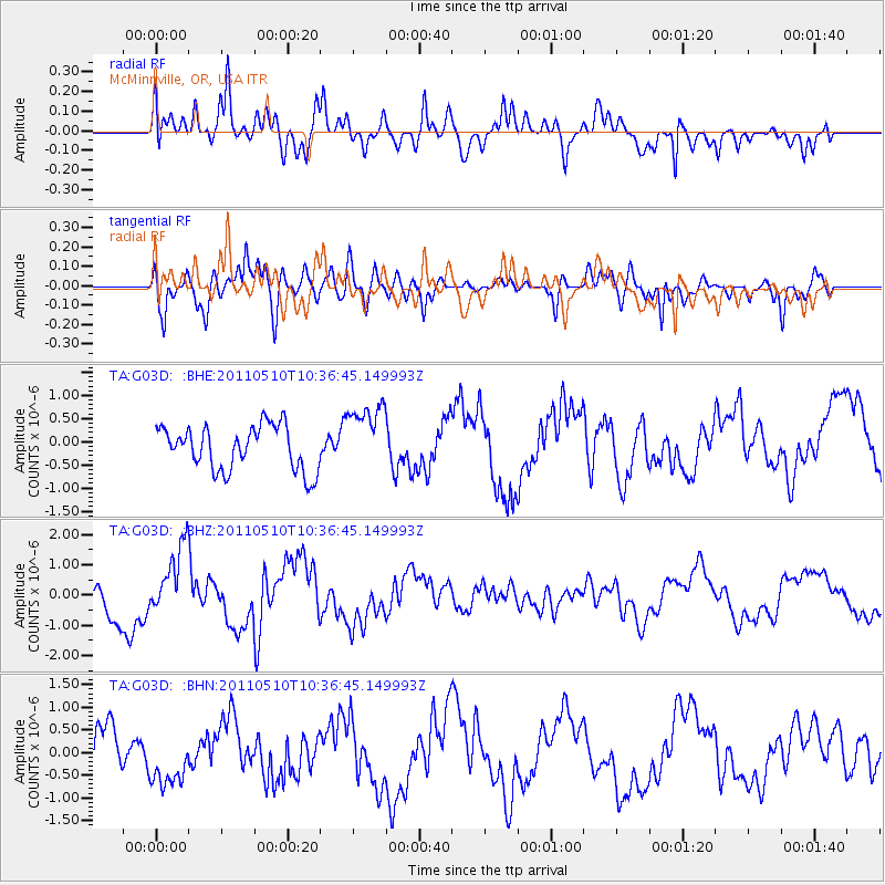
G03D McMinnville, OR, USA - Earthquake Result Viewer
*The percent match for this event was below the threshold and hence no stack was calculated.
| Earthquake location: |
Loyalty Islands |
| Earthquake latitude/longitude: |
-20.3/168.4 |
| Earthquake time(UTC): |
2011/05/10 (130) 10:24:17 GMT |
| Earthquake Depth: |
10 km |
| Earthquake Magnitude: |
5.7 MB, 5.8 MS, 5.9 MW |
| Earthquake Catalog/Contributor: |
WHDF/NEIC |
|
| Network: |
TA USArray Transportable Network (new EarthScope stations) |
| Station: |
G03D McMinnville, OR, USA |
| Lat/Lon: |
45.21 N/123.26 W |
| Elevation: |
222 m |
|
| Distance: |
89.9 deg |
| Az: |
41.068 deg |
| Baz: |
240.752 deg |
| Ray Param: |
$rayparam |
*The percent match for this event was below the threshold and hence was not used in the summary stack. |
|
| Radial Match: |
69.15185 % |
| Radial Bump: |
400 |
| Transverse Match: |
76.56179 % |
| Transverse Bump: |
400 |
| SOD ConfigId: |
390285 |
| Insert Time: |
2011-10-18 07:10:21.372 +0000 |
| GWidth: |
2.5 |
| Max Bumps: |
400 |
| Tol: |
0.001 |
|
Signal To Noise
| Channel | StoN | STA | LTA |
| TA:G03D: :BHZ:20110510T10:36:45.149993Z | 1.7436703 | 1.1175032E-6 | 6.4089136E-7 |
| TA:G03D: :BHN:20110510T10:36:45.149993Z | 1.4366406 | 6.400793E-7 | 4.455389E-7 |
| TA:G03D: :BHE:20110510T10:36:45.149993Z | 1.5686421 | 7.4707606E-7 | 4.7625653E-7 |
| Arrivals |
| Ps | |
| PpPs | |
| PsPs/PpSs | |


