You are here: Home > Network List > G - GEOSCOPE Stations List
> Station INU Inuyama, Japan > Earthquake Result Viewer
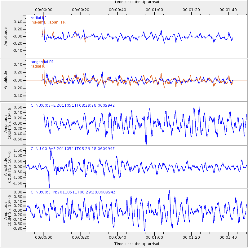
INU Inuyama, Japan - Earthquake Result Viewer
*The percent match for this event was below the threshold and hence no stack was calculated.
| Earthquake location: |
Loyalty Islands |
| Earthquake latitude/longitude: |
-20.3/168.3 |
| Earthquake time(UTC): |
2011/05/11 (131) 08:19:33 GMT |
| Earthquake Depth: |
10 km |
| Earthquake Magnitude: |
5.8 MB, 5.2 MS, 5.6 MW, 5.6 MW |
| Earthquake Catalog/Contributor: |
WHDF/NEIC |
|
| Network: |
G GEOSCOPE |
| Station: |
INU Inuyama, Japan |
| Lat/Lon: |
35.35 N/137.03 E |
| Elevation: |
132 m |
|
| Distance: |
62.8 deg |
| Az: |
331.465 deg |
| Baz: |
146.734 deg |
| Ray Param: |
$rayparam |
*The percent match for this event was below the threshold and hence was not used in the summary stack. |
|
| Radial Match: |
64.867256 % |
| Radial Bump: |
400 |
| Transverse Match: |
67.59592 % |
| Transverse Bump: |
400 |
| SOD ConfigId: |
390285 |
| Insert Time: |
2011-10-18 07:38:43.308 +0000 |
| GWidth: |
2.5 |
| Max Bumps: |
400 |
| Tol: |
0.001 |
|
Signal To Noise
| Channel | StoN | STA | LTA |
| G:INU:00:BHZ:20110511T08:29:28.060994Z | 3.4129822 | 7.97331E-7 | 2.3361709E-7 |
| G:INU:00:BHN:20110511T08:29:28.060994Z | 0.76284647 | 1.9263422E-7 | 2.525203E-7 |
| G:INU:00:BHE:20110511T08:29:28.060994Z | 1.5634098 | 2.606598E-7 | 1.6672519E-7 |
| Arrivals |
| Ps | |
| PpPs | |
| PsPs/PpSs | |


