You are here: Home > Network List > TA - USArray Transportable Network (new EarthScope stations) Stations List
> Station J01D Myrtle Point, OR, USA > Earthquake Result Viewer
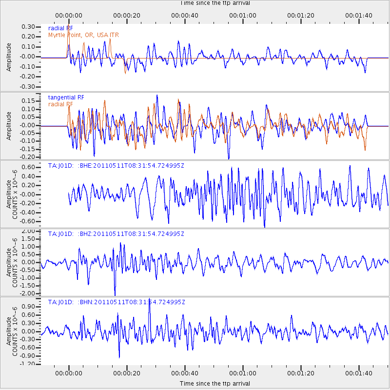
J01D Myrtle Point, OR, USA - Earthquake Result Viewer
*The percent match for this event was below the threshold and hence no stack was calculated.
| Earthquake location: |
Loyalty Islands |
| Earthquake latitude/longitude: |
-20.3/168.3 |
| Earthquake time(UTC): |
2011/05/11 (131) 08:19:33 GMT |
| Earthquake Depth: |
10 km |
| Earthquake Magnitude: |
5.8 MB, 5.2 MS, 5.6 MW, 5.6 MW |
| Earthquake Catalog/Contributor: |
WHDF/NEIC |
|
| Network: |
TA USArray Transportable Network (new EarthScope stations) |
| Station: |
J01D Myrtle Point, OR, USA |
| Lat/Lon: |
43.16 N/123.93 W |
| Elevation: |
131 m |
|
| Distance: |
88.5 deg |
| Az: |
42.633 deg |
| Baz: |
240.326 deg |
| Ray Param: |
$rayparam |
*The percent match for this event was below the threshold and hence was not used in the summary stack. |
|
| Radial Match: |
46.467594 % |
| Radial Bump: |
400 |
| Transverse Match: |
48.252197 % |
| Transverse Bump: |
400 |
| SOD ConfigId: |
390285 |
| Insert Time: |
2011-10-18 07:43:53.799 +0000 |
| GWidth: |
2.5 |
| Max Bumps: |
400 |
| Tol: |
0.001 |
|
Signal To Noise
| Channel | StoN | STA | LTA |
| TA:J01D: :BHZ:20110511T08:31:54.724995Z | 2.8209689 | 3.9197096E-7 | 1.3894906E-7 |
| TA:J01D: :BHN:20110511T08:31:54.724995Z | 0.91497314 | 1.7139216E-7 | 1.8731933E-7 |
| TA:J01D: :BHE:20110511T08:31:54.724995Z | 2.1130948 | 3.1031936E-7 | 1.4685538E-7 |
| Arrivals |
| Ps | |
| PpPs | |
| PsPs/PpSs | |


