You are here: Home > Network List > TA - USArray Transportable Network (new EarthScope stations) Stations List
> Station G34A Benson, MN, USA > Earthquake Result Viewer
G34A Benson, MN, USA - Earthquake Result Viewer

| Earthquake location: |
Costa Rica |
| Earthquake latitude/longitude: |
10.0/-84.3 |
| Earthquake time(UTC): |
2011/05/13 (133) 22:47:54 GMT |
| Earthquake Depth: |
73 km |
| Earthquake Magnitude: |
5.6 MB, 5.9 MW, 6.0 MW |
| Earthquake Catalog/Contributor: |
WHDF/NEIC |
|
| Network: |
TA USArray Transportable Network (new EarthScope stations) |
| Station: |
G34A Benson, MN, USA |
| Lat/Lon: |
45.24 N/95.64 W |
| Elevation: |
316 m |
|
| Distance: |
36.5 deg |
| Az: |
346.508 deg |
| Baz: |
161.014 deg |
| Ray Param: |
0.076439254 |
| Estimated Moho Depth: |
42.25 km |
| Estimated Crust Vp/Vs: |
1.84 |
| Assumed Crust Vp: |
6.571 km/s |
| Estimated Crust Vs: |
3.566 km/s |
| Estimated Crust Poisson's Ratio: |
0.29 |
|
| Radial Match: |
88.50582 % |
| Radial Bump: |
400 |
| Transverse Match: |
49.32137 % |
| Transverse Bump: |
400 |
| SOD ConfigId: |
390285 |
| Insert Time: |
2011-10-18 08:26:46.513 +0000 |
| GWidth: |
2.5 |
| Max Bumps: |
400 |
| Tol: |
0.001 |
|
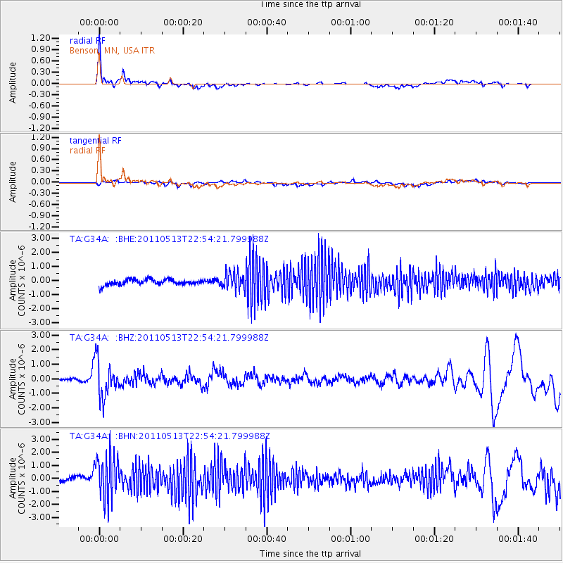
Signal To Noise
| Channel | StoN | STA | LTA |
| TA:G34A: :BHZ:20110513T22:54:21.799988Z | 11.353638 | 1.2002125E-6 | 1.0571172E-7 |
| TA:G34A: :BHN:20110513T22:54:21.799988Z | 8.284188 | 1.6436485E-6 | 1.984079E-7 |
| TA:G34A: :BHE:20110513T22:54:21.799988Z | 3.048467 | 6.011946E-7 | 1.972121E-7 |
| Arrivals |
| Ps | 5.8 SECOND |
| PpPs | 17 SECOND |
| PsPs/PpSs | 23 SECOND |


