You are here: Home > Network List > US - United States National Seismic Network Stations List
> Station MSO Missoula, Montana, USA > Earthquake Result Viewer
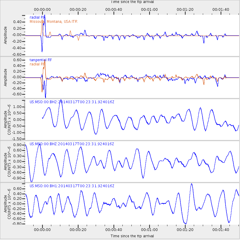
MSO Missoula, Montana, USA - Earthquake Result Viewer
*The percent match for this event was below the threshold and hence no stack was calculated.
| Earthquake location: |
Near Coast Of Northern Chile |
| Earthquake latitude/longitude: |
-20.0/-70.7 |
| Earthquake time(UTC): |
2014/03/17 (076) 00:12:11 GMT |
| Earthquake Depth: |
19 km |
| Earthquake Magnitude: |
5.1 mb |
| Earthquake Catalog/Contributor: |
ISC/ISC |
|
| Network: |
US United States National Seismic Network |
| Station: |
MSO Missoula, Montana, USA |
| Lat/Lon: |
46.83 N/113.94 W |
| Elevation: |
1264 m |
|
| Distance: |
77.1 deg |
| Az: |
331.154 deg |
| Baz: |
138.634 deg |
| Ray Param: |
$rayparam |
*The percent match for this event was below the threshold and hence was not used in the summary stack. |
|
| Radial Match: |
70.26638 % |
| Radial Bump: |
400 |
| Transverse Match: |
61.412445 % |
| Transverse Bump: |
400 |
| SOD ConfigId: |
3390531 |
| Insert Time: |
2019-04-10 17:07:14.634 +0000 |
| GWidth: |
2.5 |
| Max Bumps: |
400 |
| Tol: |
0.001 |
|
Signal To Noise
| Channel | StoN | STA | LTA |
| US:MSO:00:BHZ:20140317T00:23:31.924016Z | 0.5939735 | 4.282123E-7 | 7.2092826E-7 |
| US:MSO:00:BH1:20140317T00:23:31.924016Z | 0.7794814 | 1.9780099E-7 | 2.5375974E-7 |
| US:MSO:00:BH2:20140317T00:23:31.924016Z | 1.3388883 | 8.0292983E-7 | 5.996989E-7 |
| Arrivals |
| Ps | |
| PpPs | |
| PsPs/PpSs | |


