You are here: Home > Network List > IW - Intermountain West Stations List
> Station MOOW Moose Ponds, Wyoming, USA > Earthquake Result Viewer
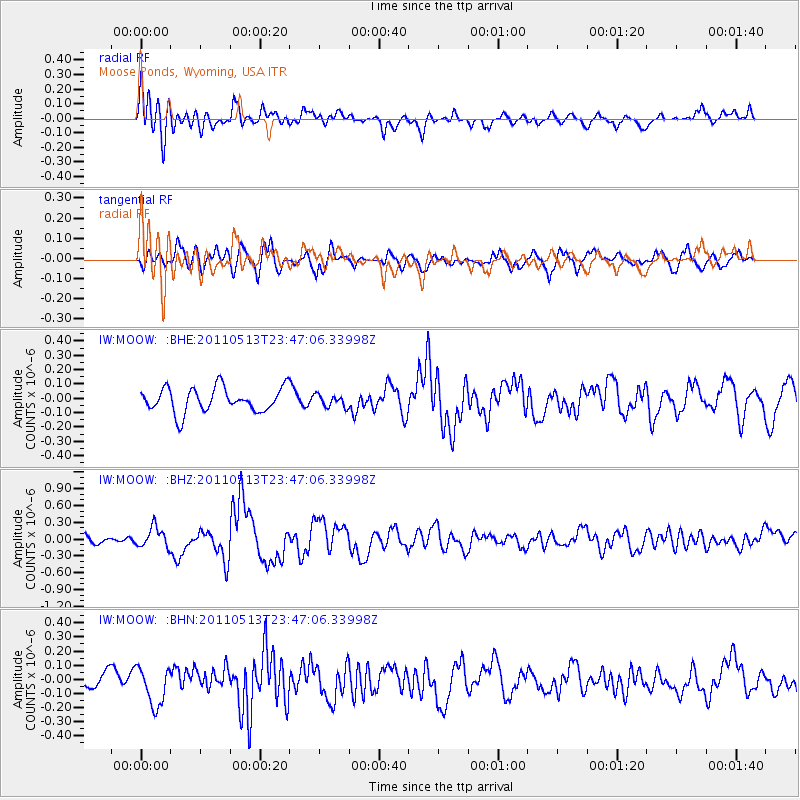
MOOW Moose Ponds, Wyoming, USA - Earthquake Result Viewer
*The percent match for this event was below the threshold and hence no stack was calculated.
| Earthquake location: |
Near East Coast Of Honshu, Japan |
| Earthquake latitude/longitude: |
37.4/141.3 |
| Earthquake time(UTC): |
2011/05/13 (133) 23:35:52 GMT |
| Earthquake Depth: |
35 km |
| Earthquake Magnitude: |
5.6 MB, 5.7 MS, 6.1 MW, 5.9 MW |
| Earthquake Catalog/Contributor: |
WHDF/NEIC |
|
| Network: |
IW Intermountain West |
| Station: |
MOOW Moose Ponds, Wyoming, USA |
| Lat/Lon: |
43.75 N/110.74 W |
| Elevation: |
2128 m |
|
| Distance: |
76.2 deg |
| Az: |
45.249 deg |
| Baz: |
308.697 deg |
| Ray Param: |
$rayparam |
*The percent match for this event was below the threshold and hence was not used in the summary stack. |
|
| Radial Match: |
79.02821 % |
| Radial Bump: |
400 |
| Transverse Match: |
52.68023 % |
| Transverse Bump: |
400 |
| SOD ConfigId: |
390285 |
| Insert Time: |
2011-10-18 09:12:35.477 +0000 |
| GWidth: |
2.5 |
| Max Bumps: |
400 |
| Tol: |
0.001 |
|
Signal To Noise
| Channel | StoN | STA | LTA |
| IW:MOOW: :BHZ:20110513T23:47:06.33998Z | 2.616802 | 1.7934714E-7 | 6.8536764E-8 |
| IW:MOOW: :BHN:20110513T23:47:06.33998Z | 2.3015268 | 1.3557923E-7 | 5.8908384E-8 |
| IW:MOOW: :BHE:20110513T23:47:06.33998Z | 0.4956066 | 4.2135284E-8 | 8.50176E-8 |
| Arrivals |
| Ps | |
| PpPs | |
| PsPs/PpSs | |


