You are here: Home > Network List > MN - MEDNET Project Stations List
> Station IDI Anogia, Greece > Earthquake Result Viewer
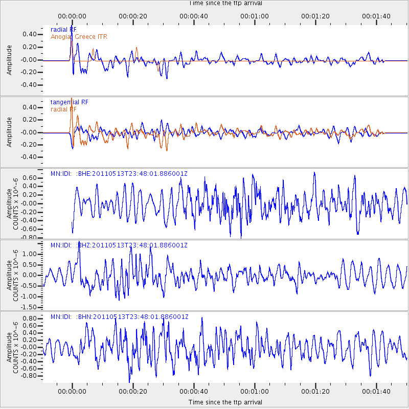
IDI Anogia, Greece - Earthquake Result Viewer
*The percent match for this event was below the threshold and hence no stack was calculated.
| Earthquake location: |
Near East Coast Of Honshu, Japan |
| Earthquake latitude/longitude: |
37.4/141.3 |
| Earthquake time(UTC): |
2011/05/13 (133) 23:35:52 GMT |
| Earthquake Depth: |
35 km |
| Earthquake Magnitude: |
5.6 MB, 5.7 MS, 6.1 MW, 5.9 MW |
| Earthquake Catalog/Contributor: |
WHDF/NEIC |
|
| Network: |
MN MEDNET Project |
| Station: |
IDI Anogia, Greece |
| Lat/Lon: |
35.29 N/24.89 E |
| Elevation: |
750 m |
|
| Distance: |
86.7 deg |
| Az: |
312.806 deg |
| Baz: |
45.58 deg |
| Ray Param: |
$rayparam |
*The percent match for this event was below the threshold and hence was not used in the summary stack. |
|
| Radial Match: |
69.06414 % |
| Radial Bump: |
400 |
| Transverse Match: |
59.057884 % |
| Transverse Bump: |
400 |
| SOD ConfigId: |
390285 |
| Insert Time: |
2011-10-18 09:14:35.020 +0000 |
| GWidth: |
2.5 |
| Max Bumps: |
400 |
| Tol: |
0.001 |
|
Signal To Noise
| Channel | StoN | STA | LTA |
| MN:IDI: :BHZ:20110513T23:48:01.886001Z | 2.7578535 | 6.2634183E-7 | 2.2711207E-7 |
| MN:IDI: :BHN:20110513T23:48:01.886001Z | 1.6090215 | 2.813962E-7 | 1.7488655E-7 |
| MN:IDI: :BHE:20110513T23:48:01.886001Z | 1.2356442 | 3.0523864E-7 | 2.4702794E-7 |
| Arrivals |
| Ps | |
| PpPs | |
| PsPs/PpSs | |


