You are here: Home > Network List > TA - USArray Transportable Network (new EarthScope stations) Stations List
> Station E25A Miller Ranch, Amidon, ND, USA > Earthquake Result Viewer
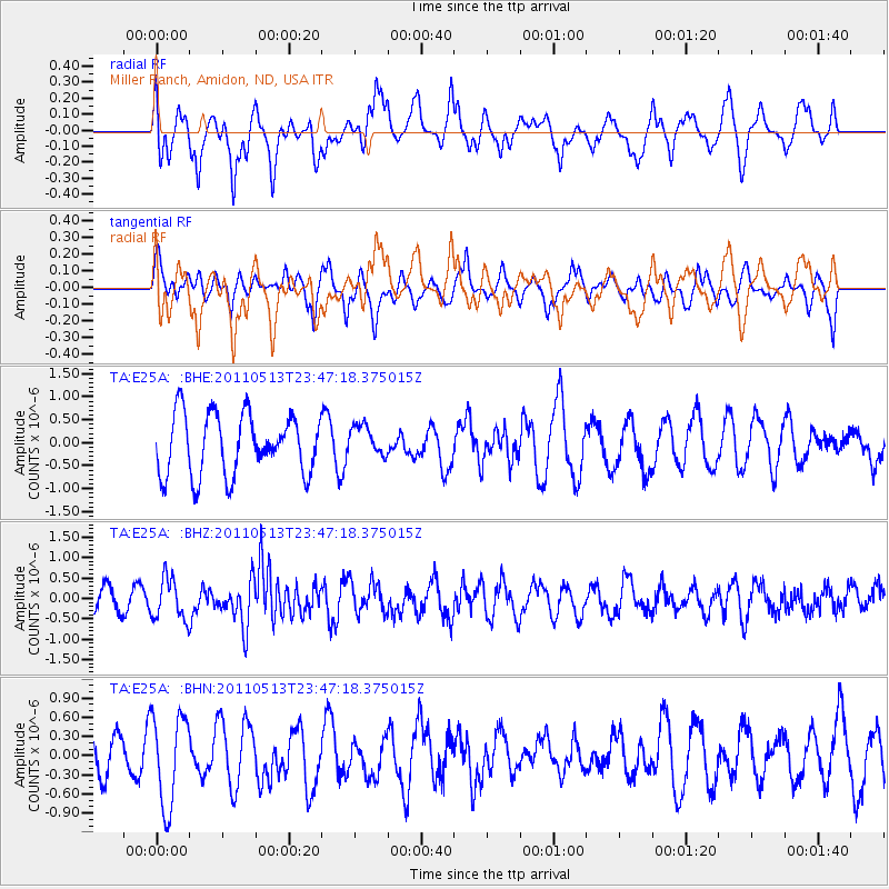
E25A Miller Ranch, Amidon, ND, USA - Earthquake Result Viewer
*The percent match for this event was below the threshold and hence no stack was calculated.
| Earthquake location: |
Near East Coast Of Honshu, Japan |
| Earthquake latitude/longitude: |
37.4/141.3 |
| Earthquake time(UTC): |
2011/05/13 (133) 23:35:52 GMT |
| Earthquake Depth: |
35 km |
| Earthquake Magnitude: |
5.6 MB, 5.7 MS, 6.1 MW, 5.9 MW |
| Earthquake Catalog/Contributor: |
WHDF/NEIC |
|
| Network: |
TA USArray Transportable Network (new EarthScope stations) |
| Station: |
E25A Miller Ranch, Amidon, ND, USA |
| Lat/Lon: |
46.50 N/103.40 W |
| Elevation: |
885 m |
|
| Distance: |
78.3 deg |
| Az: |
39.639 deg |
| Baz: |
312.649 deg |
| Ray Param: |
$rayparam |
*The percent match for this event was below the threshold and hence was not used in the summary stack. |
|
| Radial Match: |
62.84982 % |
| Radial Bump: |
400 |
| Transverse Match: |
35.432365 % |
| Transverse Bump: |
339 |
| SOD ConfigId: |
390285 |
| Insert Time: |
2011-10-18 09:18:25.412 +0000 |
| GWidth: |
2.5 |
| Max Bumps: |
400 |
| Tol: |
0.001 |
|
Signal To Noise
| Channel | StoN | STA | LTA |
| TA:E25A: :BHZ:20110513T23:47:18.375015Z | 2.2281888 | 5.063038E-7 | 2.2722664E-7 |
| TA:E25A: :BHN:20110513T23:47:18.375015Z | 1.5463076 | 7.0856356E-7 | 4.5822938E-7 |
| TA:E25A: :BHE:20110513T23:47:18.375015Z | 0.5089918 | 3.3366493E-7 | 6.555408E-7 |
| Arrivals |
| Ps | |
| PpPs | |
| PsPs/PpSs | |


