E31A Nome, ND, USA - Earthquake Result Viewer
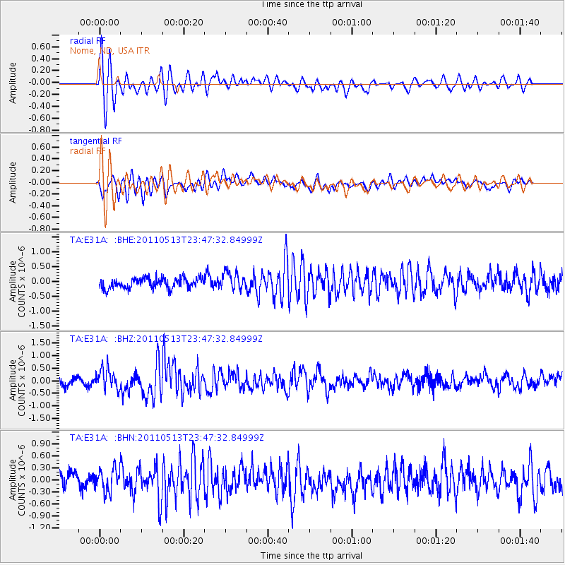
Earthquake location: Near East Coast Of Honshu, Japan
Earthquake latitude/longitude: 37.4/141.3
Earthquake time(UTC): 2011/05/13 (133) 23:35:52 GMT
Earthquake Depth: 35 km
Earthquake Magnitude: 5.6 MB, 5.7 MS, 6.1 MW, 5.9 MW
Earthquake Catalog/Contributor: WHDF/NEIC
Network: TA USArray Transportable Network (new EarthScope stations)
Station: E31A Nome, ND, USA
Lat/Lon: 46.56 N/97.89 W
Elevation: 427 m
Distance: 81.0 deg
Az: 36.891 deg
Baz: 316.145 deg
Ray Param: 0.04784862
Estimated Moho Depth: 14.0 km
Estimated Crust Vp/Vs: 2.10
Assumed Crust Vp: 6.498 km/s
Estimated Crust Vs: 3.098 km/s
Estimated Crust Poisson's Ratio: 0.35
Radial Match: 81.08136 %
Radial Bump: 400
Transverse Match: 69.94109 %
Transverse Bump: 400
SOD ConfigId: 390285
Insert Time: 2011-10-18 09:25:29.037 +0000
GWidth: 2.5
Max Bumps: 400
Tol: 0.001

Signal To Noise

ChannelStoNSTALTA
TA:E31A: :BHZ:20110513T23:47:32.84999Z3.0229754.1129198E-71.3605536E-7
TA:E31A: :BHN:20110513T23:47:32.84999Z1.22903052.884638E-72.3470841E-7
TA:E31A: :BHE:20110513T23:47:32.84999Z1.73883443.0075043E-71.7296094E-7
Arrivals
Ps2.4 SECOND
PpPs6.5 SECOND
PsPs/PpSs8.9 SECOND