SOL AZ.SOL - Earthquake Result Viewer
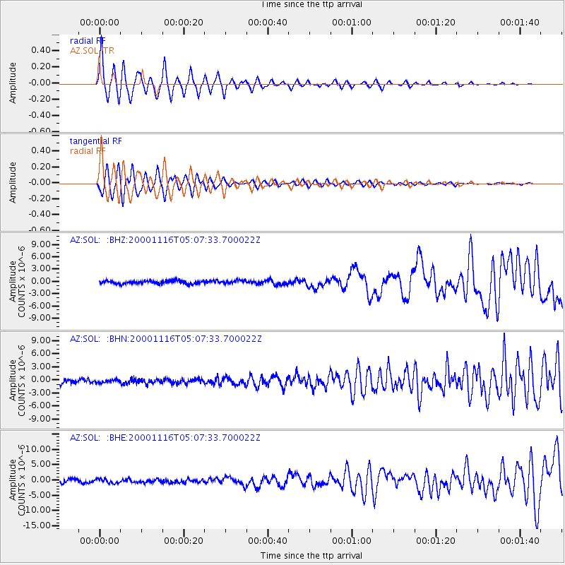
Earthquake location: New Ireland Region, P.N.G.
Earthquake latitude/longitude: -4.0/152.2
Earthquake time(UTC): 2000/11/16 (321) 04:54:56 GMT
Earthquake Depth: 33 km
Earthquake Magnitude: 6.0 MB, 8.2 MS, 8.0 MW, 8.0 ME
Earthquake Catalog/Contributor: WHDF/NEIC
Network: AZ ANZA Regional Network
Station: SOL AZ.SOL
Lat/Lon: 32.84 N/117.25 W
Elevation: 245 m
Distance: 92.6 deg
Az: 57.423 deg
Baz: 266.984 deg
Ray Param: 0.04141102
Estimated Moho Depth: 20.5 km
Estimated Crust Vp/Vs: 2.09
Assumed Crust Vp: 6.264 km/s
Estimated Crust Vs: 3.001 km/s
Estimated Crust Poisson's Ratio: 0.35
Radial Match: 94.27486 %
Radial Bump: 400
Transverse Match: 87.75257 %
Transverse Bump: 400
SOD ConfigId: 3744
Insert Time: 2010-02-26 21:06:24.048 +0000
GWidth: 2.5
Max Bumps: 400
Tol: 0.001

Signal To Noise

ChannelStoNSTALTA
AZ:SOL: :BHN:20001116T05:07:33.700022Z0.720273143.4769909E-74.827323E-7
AZ:SOL: :BHE:20001116T05:07:33.700022Z1.23993176.970997E-75.622082E-7
AZ:SOL: :BHZ:20001116T05:07:33.700022Z1.07907624.0354095E-73.7396893E-7
Arrivals
Ps3.6 SECOND
PpPs9.9 SECOND
PsPs/PpSs14 SECOND