You are here: Home > Network List > IC - New China Digital Seismograph Network Stations List
> Station ENH Enshi, Hubei Province, China > Earthquake Result Viewer
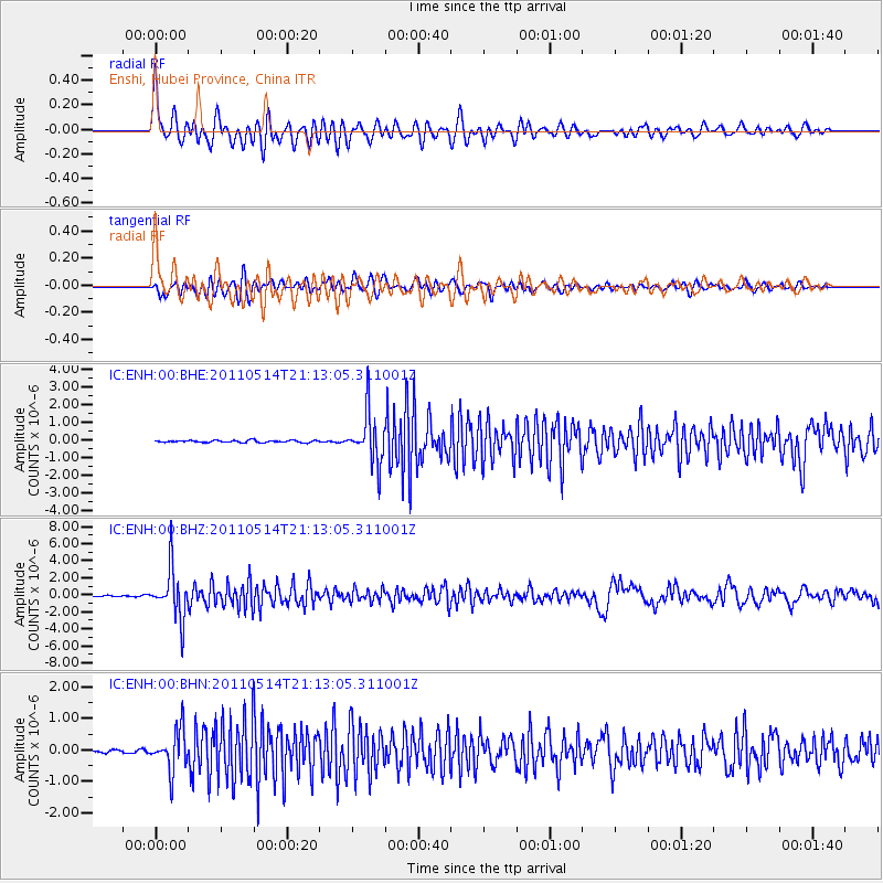
ENH Enshi, Hubei Province, China - Earthquake Result Viewer
*The percent match for this event was below the threshold and hence no stack was calculated.
| Earthquake location: |
Hindu Kush Region, Afghanistan |
| Earthquake latitude/longitude: |
36.4/70.7 |
| Earthquake time(UTC): |
2011/05/14 (134) 21:07:22 GMT |
| Earthquake Depth: |
207 km |
| Earthquake Magnitude: |
5.8 MB, 6.0 MW, 6.0 MW |
| Earthquake Catalog/Contributor: |
WHDF/NEIC |
|
| Network: |
IC New China Digital Seismograph Network |
| Station: |
ENH Enshi, Hubei Province, China |
| Lat/Lon: |
30.28 N/109.49 E |
| Elevation: |
500 m |
|
| Distance: |
32.8 deg |
| Az: |
89.369 deg |
| Baz: |
291.178 deg |
| Ray Param: |
$rayparam |
*The percent match for this event was below the threshold and hence was not used in the summary stack. |
|
| Radial Match: |
75.31888 % |
| Radial Bump: |
400 |
| Transverse Match: |
74.060295 % |
| Transverse Bump: |
400 |
| SOD ConfigId: |
391883 |
| Insert Time: |
2011-10-22 23:23:58.948 +0000 |
| GWidth: |
2.5 |
| Max Bumps: |
400 |
| Tol: |
0.001 |
|
Signal To Noise
| Channel | StoN | STA | LTA |
| IC:ENH:00:BHZ:20110514T21:13:05.311001Z | 31.357342 | 2.9128498E-6 | 9.2892115E-8 |
| IC:ENH:00:BHN:20110514T21:13:05.311001Z | 9.292612 | 6.461306E-7 | 6.9531644E-8 |
| IC:ENH:00:BHE:20110514T21:13:05.311001Z | 22.59897 | 1.3456802E-6 | 5.9546082E-8 |
| Arrivals |
| Ps | |
| PpPs | |
| PsPs/PpSs | |


