You are here: Home > Network List > TA - USArray Transportable Network (new EarthScope stations) Stations List
> Station P57A Homestead Farm, Martinsburg, WV, USA > Earthquake Result Viewer
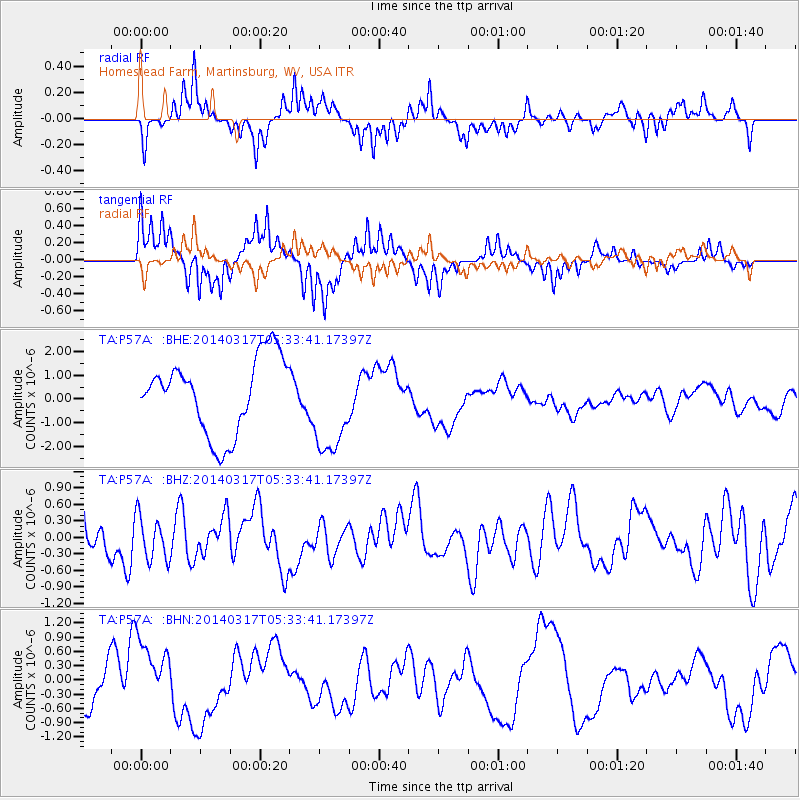
P57A Homestead Farm, Martinsburg, WV, USA - Earthquake Result Viewer
*The percent match for this event was below the threshold and hence no stack was calculated.
| Earthquake location: |
Near Coast Of Northern Chile |
| Earthquake latitude/longitude: |
-20.1/-70.8 |
| Earthquake time(UTC): |
2014/03/17 (076) 05:24:07 GMT |
| Earthquake Depth: |
10 km |
| Earthquake Magnitude: |
4.6 mb |
| Earthquake Catalog/Contributor: |
ISC/ISC |
|
| Network: |
TA USArray Transportable Network (new EarthScope stations) |
| Station: |
P57A Homestead Farm, Martinsburg, WV, USA |
| Lat/Lon: |
39.48 N/78.01 W |
| Elevation: |
191 m |
|
| Distance: |
59.7 deg |
| Az: |
353.507 deg |
| Baz: |
172.106 deg |
| Ray Param: |
$rayparam |
*The percent match for this event was below the threshold and hence was not used in the summary stack. |
|
| Radial Match: |
59.06737 % |
| Radial Bump: |
335 |
| Transverse Match: |
63.58073 % |
| Transverse Bump: |
261 |
| SOD ConfigId: |
3390531 |
| Insert Time: |
2019-04-10 17:20:59.292 +0000 |
| GWidth: |
2.5 |
| Max Bumps: |
400 |
| Tol: |
0.001 |
|
Signal To Noise
| Channel | StoN | STA | LTA |
| TA:P57A: :BHZ:20140317T05:33:41.17397Z | 0.84939027 | 3.9863255E-7 | 4.693161E-7 |
| TA:P57A: :BHN:20140317T05:33:41.17397Z | 2.1582174 | 7.102324E-7 | 3.290829E-7 |
| TA:P57A: :BHE:20140317T05:33:41.17397Z | 1.3065913 | 2.068503E-6 | 1.5831293E-6 |
| Arrivals |
| Ps | |
| PpPs | |
| PsPs/PpSs | |


