You are here: Home > Network List > TA - USArray Transportable Network (new EarthScope stations) Stations List
> Station F36A Milaca, MN, USA > Earthquake Result Viewer
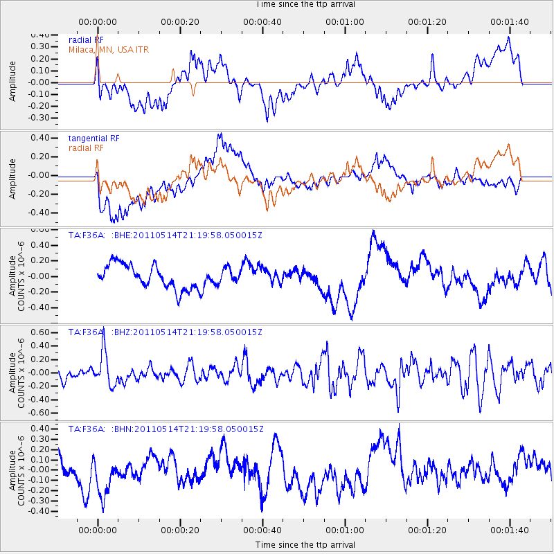
F36A Milaca, MN, USA - Earthquake Result Viewer
*The percent match for this event was below the threshold and hence no stack was calculated.
| Earthquake location: |
Hindu Kush Region, Afghanistan |
| Earthquake latitude/longitude: |
36.4/70.7 |
| Earthquake time(UTC): |
2011/05/14 (134) 21:07:22 GMT |
| Earthquake Depth: |
207 km |
| Earthquake Magnitude: |
5.8 MB, 6.0 MW, 6.0 MW |
| Earthquake Catalog/Contributor: |
WHDF/NEIC |
|
| Network: |
TA USArray Transportable Network (new EarthScope stations) |
| Station: |
F36A Milaca, MN, USA |
| Lat/Lon: |
45.86 N/93.52 W |
| Elevation: |
345 m |
|
| Distance: |
96.9 deg |
| Az: |
349.001 deg |
| Baz: |
12.724 deg |
| Ray Param: |
$rayparam |
*The percent match for this event was below the threshold and hence was not used in the summary stack. |
|
| Radial Match: |
58.82034 % |
| Radial Bump: |
400 |
| Transverse Match: |
45.437977 % |
| Transverse Bump: |
400 |
| SOD ConfigId: |
391883 |
| Insert Time: |
2011-10-22 23:32:12.185 +0000 |
| GWidth: |
2.5 |
| Max Bumps: |
400 |
| Tol: |
0.001 |
|
Signal To Noise
| Channel | StoN | STA | LTA |
| TA:F36A: :BHZ:20110514T21:19:58.050015Z | 3.194204 | 2.644105E-7 | 8.27782E-8 |
| TA:F36A: :BHN:20110514T21:19:58.050015Z | 1.0100437 | 1.8446164E-7 | 1.8262739E-7 |
| TA:F36A: :BHE:20110514T21:19:58.050015Z | 0.5949481 | 9.210254E-8 | 1.5480768E-7 |
| Arrivals |
| Ps | |
| PpPs | |
| PsPs/PpSs | |


