You are here: Home > Network List > TA - USArray Transportable Network (new EarthScope stations) Stations List
> Station G35A Watkins, MN, USA > Earthquake Result Viewer
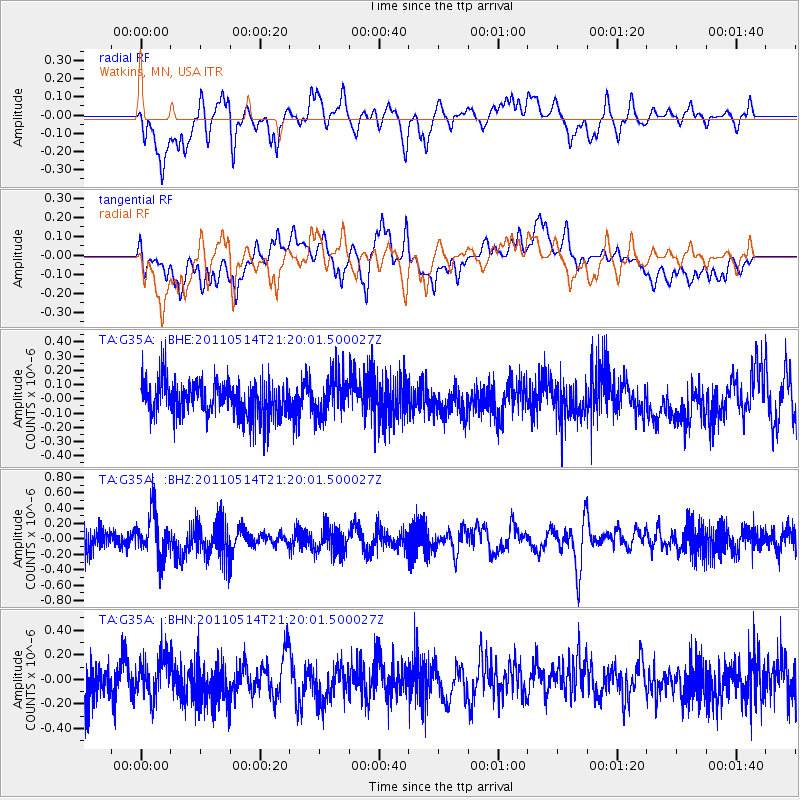
G35A Watkins, MN, USA - Earthquake Result Viewer
*The percent match for this event was below the threshold and hence no stack was calculated.
| Earthquake location: |
Hindu Kush Region, Afghanistan |
| Earthquake latitude/longitude: |
36.4/70.7 |
| Earthquake time(UTC): |
2011/05/14 (134) 21:07:22 GMT |
| Earthquake Depth: |
207 km |
| Earthquake Magnitude: |
5.8 MB, 6.0 MW, 6.0 MW |
| Earthquake Catalog/Contributor: |
WHDF/NEIC |
|
| Network: |
TA USArray Transportable Network (new EarthScope stations) |
| Station: |
G35A Watkins, MN, USA |
| Lat/Lon: |
45.22 N/94.49 W |
| Elevation: |
361 m |
|
| Distance: |
97.7 deg |
| Az: |
349.528 deg |
| Baz: |
11.974 deg |
| Ray Param: |
$rayparam |
*The percent match for this event was below the threshold and hence was not used in the summary stack. |
|
| Radial Match: |
51.02633 % |
| Radial Bump: |
400 |
| Transverse Match: |
57.184994 % |
| Transverse Bump: |
400 |
| SOD ConfigId: |
391883 |
| Insert Time: |
2011-10-22 23:32:37.043 +0000 |
| GWidth: |
2.5 |
| Max Bumps: |
400 |
| Tol: |
0.001 |
|
Signal To Noise
| Channel | StoN | STA | LTA |
| TA:G35A: :BHZ:20110514T21:20:01.500027Z | 1.7322376 | 2.81762E-7 | 1.6265783E-7 |
| TA:G35A: :BHN:20110514T21:20:01.500027Z | 0.852346 | 1.6582709E-7 | 1.9455372E-7 |
| TA:G35A: :BHE:20110514T21:20:01.500027Z | 1.1222423 | 1.3726354E-7 | 1.2231186E-7 |
| Arrivals |
| Ps | |
| PpPs | |
| PsPs/PpSs | |


