You are here: Home > Network List > TA - USArray Transportable Network (new EarthScope stations) Stations List
> Station A33A Warroad, MN, USA > Earthquake Result Viewer
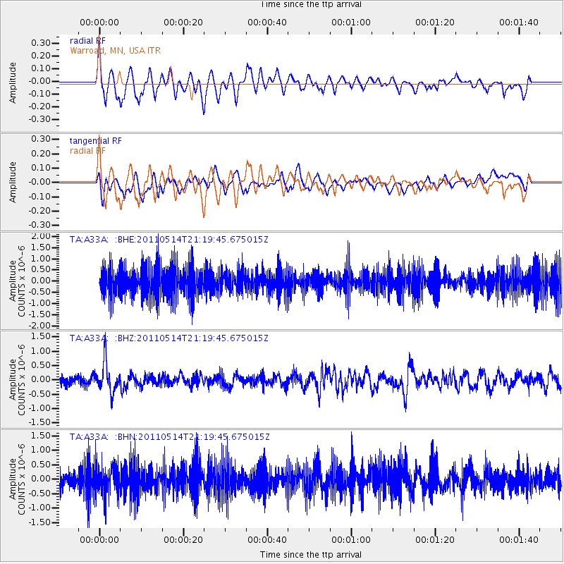
A33A Warroad, MN, USA - Earthquake Result Viewer
*The percent match for this event was below the threshold and hence no stack was calculated.
| Earthquake location: |
Hindu Kush Region, Afghanistan |
| Earthquake latitude/longitude: |
36.4/70.7 |
| Earthquake time(UTC): |
2011/05/14 (134) 21:07:22 GMT |
| Earthquake Depth: |
207 km |
| Earthquake Magnitude: |
5.8 MB, 6.0 MW, 6.0 MW |
| Earthquake Catalog/Contributor: |
WHDF/NEIC |
|
| Network: |
TA USArray Transportable Network (new EarthScope stations) |
| Station: |
A33A Warroad, MN, USA |
| Lat/Lon: |
48.94 N/95.39 W |
| Elevation: |
329 m |
|
| Distance: |
94.1 deg |
| Az: |
350.887 deg |
| Baz: |
11.173 deg |
| Ray Param: |
$rayparam |
*The percent match for this event was below the threshold and hence was not used in the summary stack. |
|
| Radial Match: |
76.97797 % |
| Radial Bump: |
400 |
| Transverse Match: |
55.751328 % |
| Transverse Bump: |
400 |
| SOD ConfigId: |
391883 |
| Insert Time: |
2011-10-22 23:33:01.533 +0000 |
| GWidth: |
2.5 |
| Max Bumps: |
400 |
| Tol: |
0.001 |
|
Signal To Noise
| Channel | StoN | STA | LTA |
| TA:A33A: :BHZ:20110514T21:19:45.675015Z | 2.937415 | 5.330705E-7 | 1.8147605E-7 |
| TA:A33A: :BHN:20110514T21:19:45.675015Z | 1.1032534 | 5.1832404E-7 | 4.6981415E-7 |
| TA:A33A: :BHE:20110514T21:19:45.675015Z | 0.65751827 | 4.6050758E-7 | 7.0037225E-7 |
| Arrivals |
| Ps | |
| PpPs | |
| PsPs/PpSs | |


