You are here: Home > Network List > TA - USArray Transportable Network (new EarthScope stations) Stations List
> Station I36A Fitzsimmons Farm, Good Thunder, MN, USA > Earthquake Result Viewer
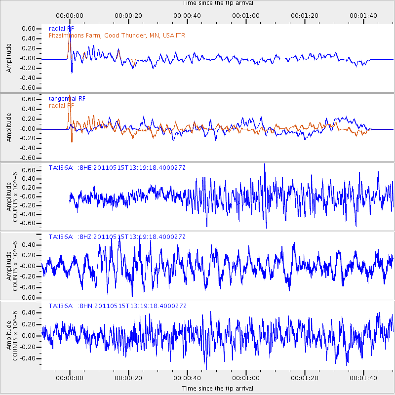
I36A Fitzsimmons Farm, Good Thunder, MN, USA - Earthquake Result Viewer
*The percent match for this event was below the threshold and hence no stack was calculated.
| Earthquake location: |
Central Mid-Atlantic Ridge |
| Earthquake latitude/longitude: |
0.6/-25.6 |
| Earthquake time(UTC): |
2011/05/15 (135) 13:08:13 GMT |
| Earthquake Depth: |
10 km |
| Earthquake Magnitude: |
5.6 MB, 5.4 MS, 6.1 MW, 6.1 MW |
| Earthquake Catalog/Contributor: |
WHDF/NEIC |
|
| Network: |
TA USArray Transportable Network (new EarthScope stations) |
| Station: |
I36A Fitzsimmons Farm, Good Thunder, MN, USA |
| Lat/Lon: |
44.02 N/94.01 W |
| Elevation: |
307 m |
|
| Distance: |
74.2 deg |
| Az: |
315.809 deg |
| Baz: |
104.948 deg |
| Ray Param: |
$rayparam |
*The percent match for this event was below the threshold and hence was not used in the summary stack. |
|
| Radial Match: |
66.64576 % |
| Radial Bump: |
400 |
| Transverse Match: |
60.094776 % |
| Transverse Bump: |
400 |
| SOD ConfigId: |
391883 |
| Insert Time: |
2011-10-22 23:50:01.493 +0000 |
| GWidth: |
2.5 |
| Max Bumps: |
400 |
| Tol: |
0.001 |
|
Signal To Noise
| Channel | StoN | STA | LTA |
| TA:I36A: :BHZ:20110515T13:19:18.400027Z | 2.289295 | 1.6139677E-7 | 7.050065E-8 |
| TA:I36A: :BHN:20110515T13:19:18.400027Z | 0.7752274 | 9.4206015E-8 | 1.2152049E-7 |
| TA:I36A: :BHE:20110515T13:19:18.400027Z | 1.4470593 | 1.4387396E-7 | 9.942507E-8 |
| Arrivals |
| Ps | |
| PpPs | |
| PsPs/PpSs | |


