You are here: Home > Network List > TA - USArray Transportable Network (new EarthScope stations) Stations List
> Station C34A RKJ Ranch, Bemidji, MN, USA > Earthquake Result Viewer
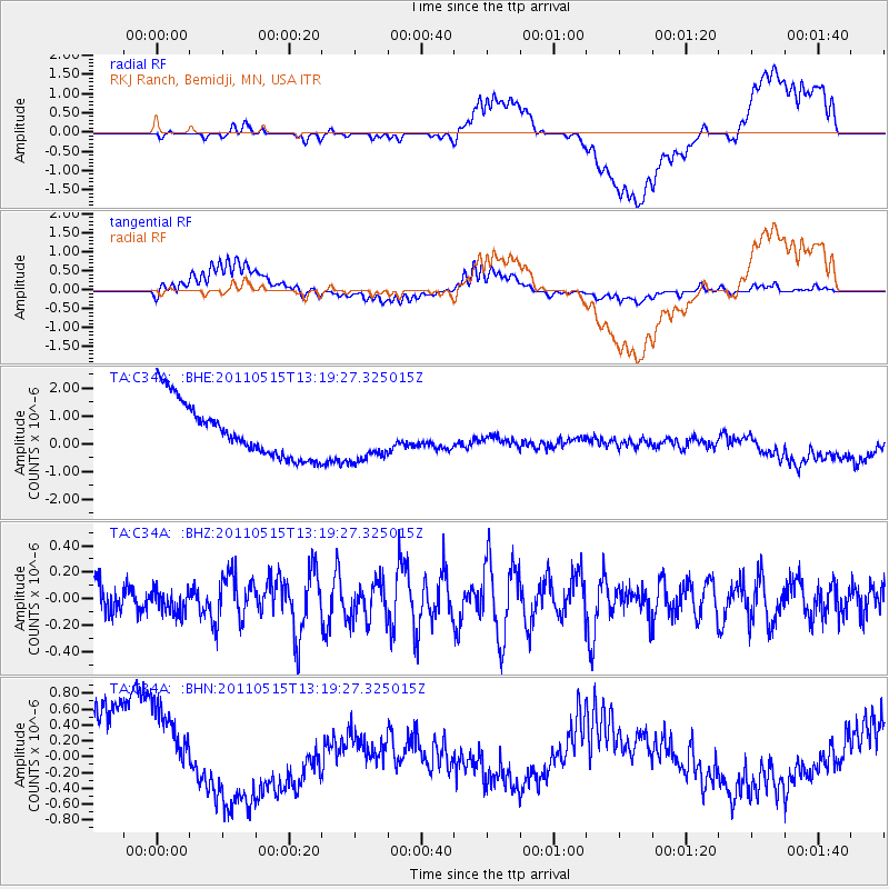
C34A RKJ Ranch, Bemidji, MN, USA - Earthquake Result Viewer
*The percent match for this event was below the threshold and hence no stack was calculated.
| Earthquake location: |
Central Mid-Atlantic Ridge |
| Earthquake latitude/longitude: |
0.6/-25.6 |
| Earthquake time(UTC): |
2011/05/15 (135) 13:08:13 GMT |
| Earthquake Depth: |
10 km |
| Earthquake Magnitude: |
5.6 MB, 5.4 MS, 6.1 MW, 6.1 MW |
| Earthquake Catalog/Contributor: |
WHDF/NEIC |
|
| Network: |
TA USArray Transportable Network (new EarthScope stations) |
| Station: |
C34A RKJ Ranch, Bemidji, MN, USA |
| Lat/Lon: |
47.65 N/94.91 W |
| Elevation: |
441 m |
|
| Distance: |
75.7 deg |
| Az: |
319.271 deg |
| Baz: |
105.206 deg |
| Ray Param: |
$rayparam |
*The percent match for this event was below the threshold and hence was not used in the summary stack. |
|
| Radial Match: |
20.864874 % |
| Radial Bump: |
400 |
| Transverse Match: |
25.518661 % |
| Transverse Bump: |
400 |
| SOD ConfigId: |
391883 |
| Insert Time: |
2011-10-22 23:50:13.353 +0000 |
| GWidth: |
2.5 |
| Max Bumps: |
400 |
| Tol: |
0.001 |
|
Signal To Noise
| Channel | StoN | STA | LTA |
| TA:C34A: :BHZ:20110515T13:19:27.325015Z | 0.82613456 | 8.8166836E-8 | 1.06722126E-7 |
| TA:C34A: :BHN:20110515T13:19:27.325015Z | 0.961593 | 6.008262E-7 | 6.248238E-7 |
| TA:C34A: :BHE:20110515T13:19:27.325015Z | 0.92014444 | 8.858519E-7 | 9.627313E-7 |
| Arrivals |
| Ps | |
| PpPs | |
| PsPs/PpSs | |


