TNA Tin City Broadband - Earthquake Result Viewer
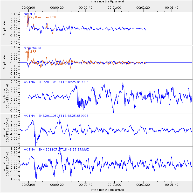
Earthquake location: Solomon Islands
Earthquake latitude/longitude: -6.1/154.4
Earthquake time(UTC): 2011/05/15 (135) 18:37:10 GMT
Earthquake Depth: 40 km
Earthquake Magnitude: 6.3 MB, 6.2 MS, 6.5 MW, 6.5 MW
Earthquake Catalog/Contributor: WHDF/NEIC
Network: AK Alaska Regional Network
Station: TNA Tin City Broadband
Lat/Lon: 65.56 N/167.92 W
Elevation: 74 m
Distance: 76.6 deg
Az: 15.147 deg
Baz: 218.649 deg
Ray Param: 0.050809257
Estimated Moho Depth: 29.75 km
Estimated Crust Vp/Vs: 1.81
Assumed Crust Vp: 6.307 km/s
Estimated Crust Vs: 3.494 km/s
Estimated Crust Poisson's Ratio: 0.28
Radial Match: 92.72334 %
Radial Bump: 400
Transverse Match: 77.91282 %
Transverse Bump: 400
SOD ConfigId: 391883
Insert Time: 2011-10-22 23:55:30.419 +0000
GWidth: 2.5
Max Bumps: 400
Tol: 0.001

Signal To Noise

ChannelStoNSTALTA
AK:TNA: :BHZ:20110515T18:48:25.85999Z13.5678211.3025051E-69.599958E-8
AK:TNA: :BHN:20110515T18:48:25.85999Z4.0889064.1672416E-71.01915816E-7
AK:TNA: :BHE:20110515T18:48:25.85999Z4.48921441.9088478E-74.2520753E-8
Arrivals
Ps3.9 SECOND
PpPs13 SECOND
PsPs/PpSs17 SECOND