You are here: Home > Network List > AZ - ANZA Regional Network Stations List
> Station SMER AZ.SMER > Earthquake Result Viewer
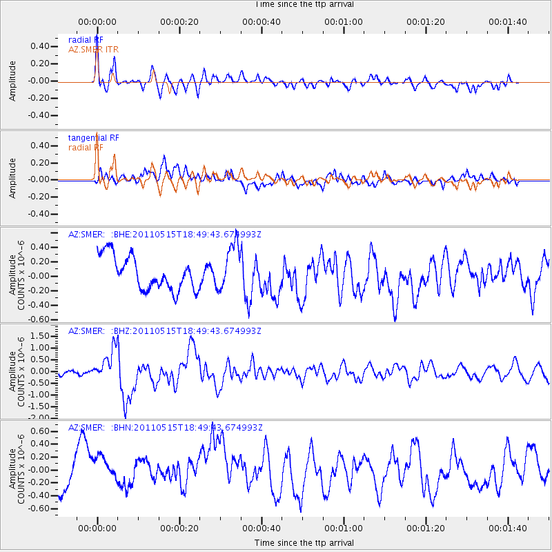
SMER AZ.SMER - Earthquake Result Viewer
*The percent match for this event was below the threshold and hence no stack was calculated.
| Earthquake location: |
Solomon Islands |
| Earthquake latitude/longitude: |
-6.1/154.4 |
| Earthquake time(UTC): |
2011/05/15 (135) 18:37:10 GMT |
| Earthquake Depth: |
40 km |
| Earthquake Magnitude: |
6.3 MB, 6.2 MS, 6.5 MW, 6.5 MW |
| Earthquake Catalog/Contributor: |
WHDF/NEIC |
|
| Network: |
AZ ANZA Regional Network |
| Station: |
SMER AZ.SMER |
| Lat/Lon: |
33.46 N/117.17 W |
| Elevation: |
355 m |
|
| Distance: |
92.0 deg |
| Az: |
56.739 deg |
| Baz: |
264.062 deg |
| Ray Param: |
$rayparam |
*The percent match for this event was below the threshold and hence was not used in the summary stack. |
|
| Radial Match: |
71.508 % |
| Radial Bump: |
400 |
| Transverse Match: |
43.72687 % |
| Transverse Bump: |
400 |
| SOD ConfigId: |
391883 |
| Insert Time: |
2011-10-22 23:59:08.943 +0000 |
| GWidth: |
2.5 |
| Max Bumps: |
400 |
| Tol: |
0.001 |
|
Signal To Noise
| Channel | StoN | STA | LTA |
| AZ:SMER: :BHZ:20110515T18:49:43.674993Z | 5.041013 | 7.058141E-7 | 1.4001435E-7 |
| AZ:SMER: :BHN:20110515T18:49:43.674993Z | 1.5815178 | 3.9626858E-7 | 2.5056218E-7 |
| AZ:SMER: :BHE:20110515T18:49:43.674993Z | 1.4153688 | 3.247875E-7 | 2.29472E-7 |
| Arrivals |
| Ps | |
| PpPs | |
| PsPs/PpSs | |


