You are here: Home > Network List > CI - Caltech Regional Seismic Network Stations List
> Station RCT Rector, Visalia, CA, USA > Earthquake Result Viewer
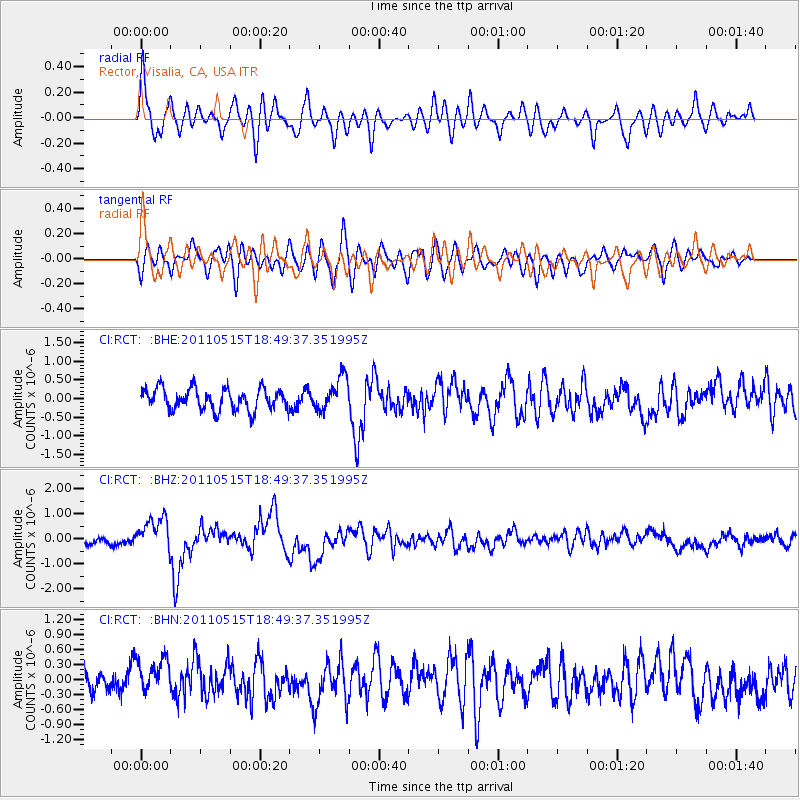
RCT Rector, Visalia, CA, USA - Earthquake Result Viewer
*The percent match for this event was below the threshold and hence no stack was calculated.
| Earthquake location: |
Solomon Islands |
| Earthquake latitude/longitude: |
-6.1/154.4 |
| Earthquake time(UTC): |
2011/05/15 (135) 18:37:10 GMT |
| Earthquake Depth: |
40 km |
| Earthquake Magnitude: |
6.3 MB, 6.2 MS, 6.5 MW, 6.5 MW |
| Earthquake Catalog/Contributor: |
WHDF/NEIC |
|
| Network: |
CI Caltech Regional Seismic Network |
| Station: |
RCT Rector, Visalia, CA, USA |
| Lat/Lon: |
36.31 N/119.24 W |
| Elevation: |
107 m |
|
| Distance: |
90.6 deg |
| Az: |
53.723 deg |
| Baz: |
262.95 deg |
| Ray Param: |
$rayparam |
*The percent match for this event was below the threshold and hence was not used in the summary stack. |
|
| Radial Match: |
67.31017 % |
| Radial Bump: |
400 |
| Transverse Match: |
75.21107 % |
| Transverse Bump: |
400 |
| SOD ConfigId: |
391883 |
| Insert Time: |
2011-10-23 00:02:29.069 +0000 |
| GWidth: |
2.5 |
| Max Bumps: |
400 |
| Tol: |
0.001 |
|
Signal To Noise
| Channel | StoN | STA | LTA |
| CI:RCT: :BHZ:20110515T18:49:37.351995Z | 4.727955 | 6.915475E-7 | 1.462678E-7 |
| CI:RCT: :BHN:20110515T18:49:37.351995Z | 2.1011882 | 3.695513E-7 | 1.7587729E-7 |
| CI:RCT: :BHE:20110515T18:49:37.351995Z | 1.5604239 | 4.411877E-7 | 2.827358E-7 |
| Arrivals |
| Ps | |
| PpPs | |
| PsPs/PpSs | |


