You are here: Home > Network List > TA - USArray Transportable Network (new EarthScope stations) Stations List
> Station G05D Wamic, OR, USA > Earthquake Result Viewer
G05D Wamic, OR, USA - Earthquake Result Viewer
*The percent match for this event was below the threshold and hence no stack was calculated.
| Earthquake location: |
Solomon Islands |
| Earthquake latitude/longitude: |
-6.1/154.4 |
| Earthquake time(UTC): |
2011/05/15 (135) 18:37:10 GMT |
| Earthquake Depth: |
40 km |
| Earthquake Magnitude: |
6.3 MB, 6.2 MS, 6.5 MW, 6.5 MW |
| Earthquake Catalog/Contributor: |
WHDF/NEIC |
|
| Network: |
TA USArray Transportable Network (new EarthScope stations) |
| Station: |
G05D Wamic, OR, USA |
| Lat/Lon: |
45.24 N/121.32 W |
| Elevation: |
592 m |
|
| Distance: |
90.3 deg |
| Az: |
44.666 deg |
| Baz: |
261.668 deg |
| Ray Param: |
$rayparam |
*The percent match for this event was below the threshold and hence was not used in the summary stack. |
|
| Radial Match: |
70.33125 % |
| Radial Bump: |
400 |
| Transverse Match: |
52.626167 % |
| Transverse Bump: |
400 |
| SOD ConfigId: |
391883 |
| Insert Time: |
2011-10-23 00:08:50.823 +0000 |
| GWidth: |
2.5 |
| Max Bumps: |
400 |
| Tol: |
0.001 |
|
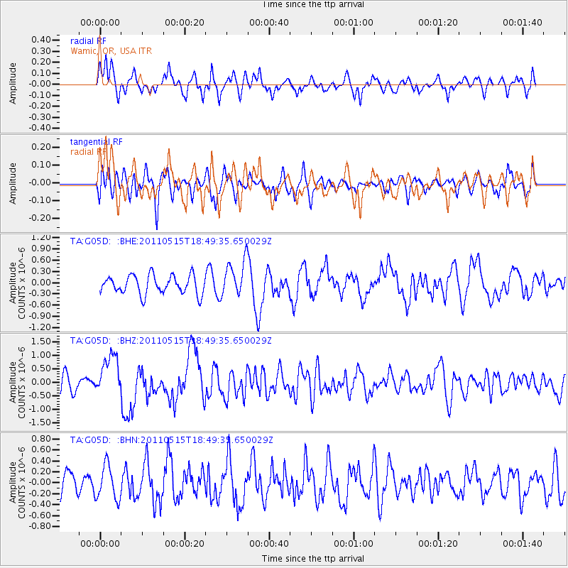
Signal To Noise
| Channel | StoN | STA | LTA |
| TA:G05D: :BHZ:20110515T18:49:35.650029Z | 3.0422058 | 7.728161E-7 | 2.540315E-7 |
| TA:G05D: :BHN:20110515T18:49:35.650029Z | 1.101924 | 3.1407393E-7 | 2.8502325E-7 |
| TA:G05D: :BHE:20110515T18:49:35.650029Z | 1.9958222 | 4.933176E-7 | 2.471751E-7 |
| Arrivals |
| Ps | |
| PpPs | |
| PsPs/PpSs | |


