You are here: Home > Network List > TA - USArray Transportable Network (new EarthScope stations) Stations List
> Station L02D Cave Junction, OR, USA > Earthquake Result Viewer
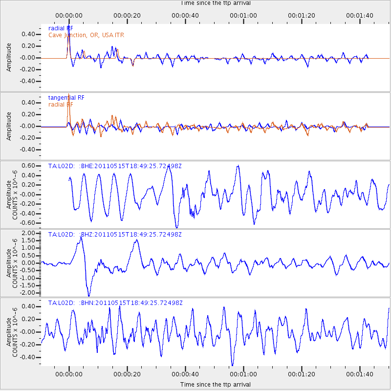
L02D Cave Junction, OR, USA - Earthquake Result Viewer
*The percent match for this event was below the threshold and hence no stack was calculated.
| Earthquake location: |
Solomon Islands |
| Earthquake latitude/longitude: |
-6.1/154.4 |
| Earthquake time(UTC): |
2011/05/15 (135) 18:37:10 GMT |
| Earthquake Depth: |
40 km |
| Earthquake Magnitude: |
6.3 MB, 6.2 MS, 6.5 MW, 6.5 MW |
| Earthquake Catalog/Contributor: |
WHDF/NEIC |
|
| Network: |
TA USArray Transportable Network (new EarthScope stations) |
| Station: |
L02D Cave Junction, OR, USA |
| Lat/Lon: |
42.16 N/123.60 W |
| Elevation: |
458 m |
|
| Distance: |
88.1 deg |
| Az: |
47.448 deg |
| Baz: |
260.133 deg |
| Ray Param: |
$rayparam |
*The percent match for this event was below the threshold and hence was not used in the summary stack. |
|
| Radial Match: |
75.99156 % |
| Radial Bump: |
400 |
| Transverse Match: |
60.50676 % |
| Transverse Bump: |
400 |
| SOD ConfigId: |
391883 |
| Insert Time: |
2011-10-23 00:09:15.071 +0000 |
| GWidth: |
2.5 |
| Max Bumps: |
400 |
| Tol: |
0.001 |
|
Signal To Noise
| Channel | StoN | STA | LTA |
| TA:L02D: :BHZ:20110515T18:49:25.72498Z | 4.1155887 | 9.681601E-7 | 2.3524221E-7 |
| TA:L02D: :BHN:20110515T18:49:25.72498Z | 1.677068 | 1.9897736E-7 | 1.1864598E-7 |
| TA:L02D: :BHE:20110515T18:49:25.72498Z | 1.1018324 | 3.3660123E-7 | 3.0549222E-7 |
| Arrivals |
| Ps | |
| PpPs | |
| PsPs/PpSs | |


