You are here: Home > Network List > TA - USArray Transportable Network (new EarthScope stations) Stations List
> Station N34A Lincoln, NE, USA > Earthquake Result Viewer
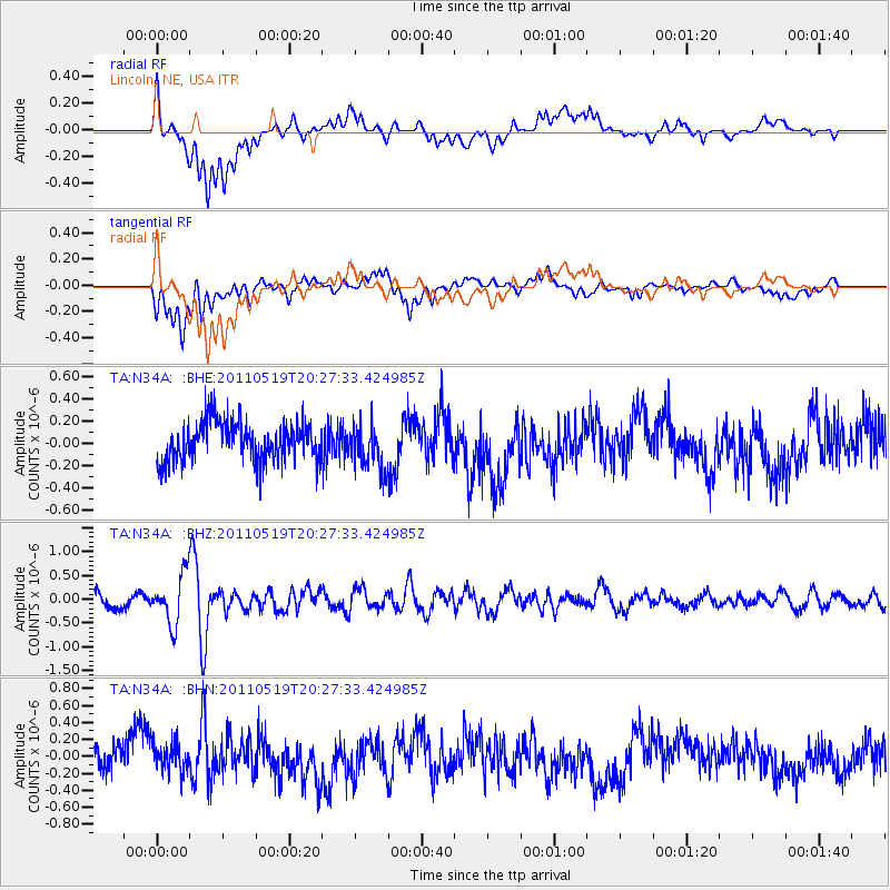
N34A Lincoln, NE, USA - Earthquake Result Viewer
*The percent match for this event was below the threshold and hence no stack was calculated.
| Earthquake location: |
Turkey |
| Earthquake latitude/longitude: |
39.1/29.1 |
| Earthquake time(UTC): |
2011/05/19 (139) 20:15:22 GMT |
| Earthquake Depth: |
7.0 km |
| Earthquake Magnitude: |
5.8 MB, 5.8 MS, 5.9 MW, 5.8 MW |
| Earthquake Catalog/Contributor: |
WHDF/NEIC |
|
| Network: |
TA USArray Transportable Network (new EarthScope stations) |
| Station: |
N34A Lincoln, NE, USA |
| Lat/Lon: |
40.84 N/96.50 W |
| Elevation: |
401 m |
|
| Distance: |
86.2 deg |
| Az: |
321.811 deg |
| Baz: |
39.317 deg |
| Ray Param: |
$rayparam |
*The percent match for this event was below the threshold and hence was not used in the summary stack. |
|
| Radial Match: |
63.727585 % |
| Radial Bump: |
400 |
| Transverse Match: |
65.90189 % |
| Transverse Bump: |
400 |
| SOD ConfigId: |
391883 |
| Insert Time: |
2011-10-23 00:50:05.890 +0000 |
| GWidth: |
2.5 |
| Max Bumps: |
400 |
| Tol: |
0.001 |
|
Signal To Noise
| Channel | StoN | STA | LTA |
| TA:N34A: :BHZ:20110519T20:27:33.424985Z | 2.771073 | 5.2252767E-7 | 1.885651E-7 |
| TA:N34A: :BHN:20110519T20:27:33.424985Z | 0.9609945 | 1.878707E-7 | 1.9549611E-7 |
| TA:N34A: :BHE:20110519T20:27:33.424985Z | 1.1731642 | 2.0662254E-7 | 1.7612413E-7 |
| Arrivals |
| Ps | |
| PpPs | |
| PsPs/PpSs | |


