You are here: Home > Network List > TA - USArray Transportable Network (new EarthScope stations) Stations List
> Station V37A Hulbert, OK, USA > Earthquake Result Viewer
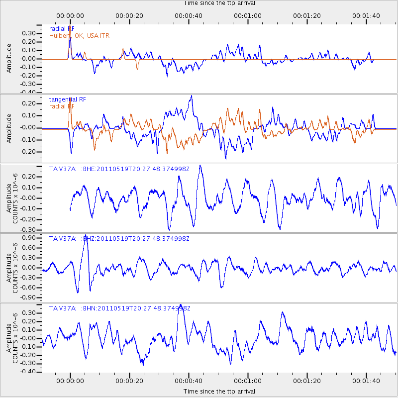
V37A Hulbert, OK, USA - Earthquake Result Viewer
*The percent match for this event was below the threshold and hence no stack was calculated.
| Earthquake location: |
Turkey |
| Earthquake latitude/longitude: |
39.1/29.1 |
| Earthquake time(UTC): |
2011/05/19 (139) 20:15:22 GMT |
| Earthquake Depth: |
7.0 km |
| Earthquake Magnitude: |
5.8 MB, 5.8 MS, 5.9 MW, 5.8 MW |
| Earthquake Catalog/Contributor: |
WHDF/NEIC |
|
| Network: |
TA USArray Transportable Network (new EarthScope stations) |
| Station: |
V37A Hulbert, OK, USA |
| Lat/Lon: |
35.88 N/95.14 W |
| Elevation: |
219 m |
|
| Distance: |
89.3 deg |
| Az: |
317.829 deg |
| Baz: |
40.003 deg |
| Ray Param: |
$rayparam |
*The percent match for this event was below the threshold and hence was not used in the summary stack. |
|
| Radial Match: |
47.390335 % |
| Radial Bump: |
400 |
| Transverse Match: |
57.16368 % |
| Transverse Bump: |
400 |
| SOD ConfigId: |
391883 |
| Insert Time: |
2011-10-23 00:51:44.628 +0000 |
| GWidth: |
2.5 |
| Max Bumps: |
400 |
| Tol: |
0.001 |
|
Signal To Noise
| Channel | StoN | STA | LTA |
| TA:V37A: :BHZ:20110519T20:27:48.374998Z | 3.6370099 | 3.9292377E-7 | 1.0803483E-7 |
| TA:V37A: :BHN:20110519T20:27:48.374998Z | 0.9626188 | 1.10905184E-7 | 1.1521194E-7 |
| TA:V37A: :BHE:20110519T20:27:48.374998Z | 1.7809446 | 1.3596888E-7 | 7.6346495E-8 |
| Arrivals |
| Ps | |
| PpPs | |
| PsPs/PpSs | |


