You are here: Home > Network List > TA - USArray Transportable Network (new EarthScope stations) Stations List
> Station U36A Oologah, OK, USA > Earthquake Result Viewer
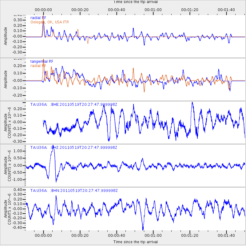
U36A Oologah, OK, USA - Earthquake Result Viewer
*The percent match for this event was below the threshold and hence no stack was calculated.
| Earthquake location: |
Turkey |
| Earthquake latitude/longitude: |
39.1/29.1 |
| Earthquake time(UTC): |
2011/05/19 (139) 20:15:22 GMT |
| Earthquake Depth: |
7.0 km |
| Earthquake Magnitude: |
5.8 MB, 5.8 MS, 5.9 MW, 5.8 MW |
| Earthquake Catalog/Contributor: |
WHDF/NEIC |
|
| Network: |
TA USArray Transportable Network (new EarthScope stations) |
| Station: |
U36A Oologah, OK, USA |
| Lat/Lon: |
36.39 N/95.73 W |
| Elevation: |
187 m |
|
| Distance: |
89.3 deg |
| Az: |
318.522 deg |
| Baz: |
39.664 deg |
| Ray Param: |
$rayparam |
*The percent match for this event was below the threshold and hence was not used in the summary stack. |
|
| Radial Match: |
77.2853 % |
| Radial Bump: |
400 |
| Transverse Match: |
43.264595 % |
| Transverse Bump: |
400 |
| SOD ConfigId: |
391883 |
| Insert Time: |
2011-10-23 00:52:33.776 +0000 |
| GWidth: |
2.5 |
| Max Bumps: |
400 |
| Tol: |
0.001 |
|
Signal To Noise
| Channel | StoN | STA | LTA |
| TA:U36A: :BHZ:20110519T20:27:47.999998Z | 5.017469 | 5.353372E-7 | 1.0669468E-7 |
| TA:U36A: :BHN:20110519T20:27:47.999998Z | 1.45595 | 1.5961969E-7 | 1.0963268E-7 |
| TA:U36A: :BHE:20110519T20:27:47.999998Z | 3.1971834 | 1.9119209E-7 | 5.9800165E-8 |
| Arrivals |
| Ps | |
| PpPs | |
| PsPs/PpSs | |


