You are here: Home > Network List > TA - USArray Transportable Network (new EarthScope stations) Stations List
> Station Z46A Louisville, MS, USA > Earthquake Result Viewer
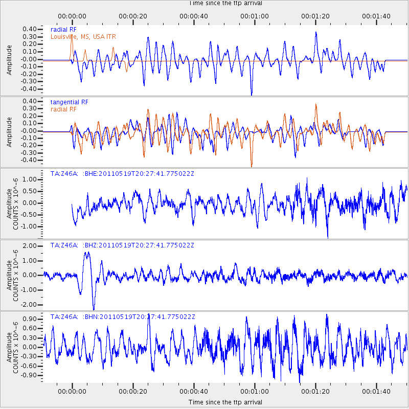
Z46A Louisville, MS, USA - Earthquake Result Viewer
*The percent match for this event was below the threshold and hence no stack was calculated.
| Earthquake location: |
Turkey |
| Earthquake latitude/longitude: |
39.1/29.1 |
| Earthquake time(UTC): |
2011/05/19 (139) 20:15:22 GMT |
| Earthquake Depth: |
7.0 km |
| Earthquake Magnitude: |
5.8 MB, 5.8 MS, 5.9 MW, 5.8 MW |
| Earthquake Catalog/Contributor: |
WHDF/NEIC |
|
| Network: |
TA USArray Transportable Network (new EarthScope stations) |
| Station: |
Z46A Louisville, MS, USA |
| Lat/Lon: |
33.19 N/88.94 W |
| Elevation: |
125 m |
|
| Distance: |
87.9 deg |
| Az: |
312.223 deg |
| Baz: |
43.371 deg |
| Ray Param: |
$rayparam |
*The percent match for this event was below the threshold and hence was not used in the summary stack. |
|
| Radial Match: |
70.432045 % |
| Radial Bump: |
400 |
| Transverse Match: |
64.070724 % |
| Transverse Bump: |
400 |
| SOD ConfigId: |
391883 |
| Insert Time: |
2011-10-23 01:05:42.833 +0000 |
| GWidth: |
2.5 |
| Max Bumps: |
400 |
| Tol: |
0.001 |
|
Signal To Noise
| Channel | StoN | STA | LTA |
| TA:Z46A: :BHZ:20110519T20:27:41.775022Z | 5.9729333 | 7.7993207E-7 | 1.3057773E-7 |
| TA:Z46A: :BHN:20110519T20:27:41.775022Z | 0.96646184 | 2.6467092E-7 | 2.738555E-7 |
| TA:Z46A: :BHE:20110519T20:27:41.775022Z | 0.7593669 | 2.3761721E-7 | 3.129149E-7 |
| Arrivals |
| Ps | |
| PpPs | |
| PsPs/PpSs | |


