You are here: Home > Network List > US - United States National Seismic Network Stations List
> Station TZTN Tazewell, Tennessee, USA > Earthquake Result Viewer
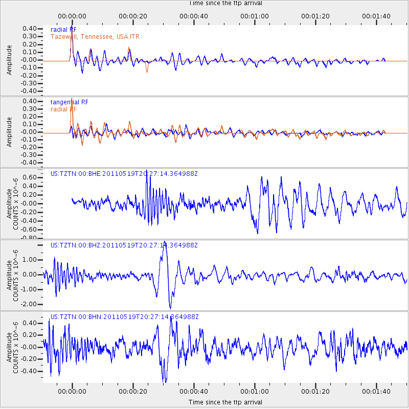
TZTN Tazewell, Tennessee, USA - Earthquake Result Viewer

| Earthquake location: |
Turkey |
| Earthquake latitude/longitude: |
39.1/29.1 |
| Earthquake time(UTC): |
2011/05/19 (139) 20:15:22 GMT |
| Earthquake Depth: |
7.0 km |
| Earthquake Magnitude: |
5.8 MB, 5.8 MS, 5.9 MW, 5.8 MW |
| Earthquake Catalog/Contributor: |
WHDF/NEIC |
|
| Network: |
US United States National Seismic Network |
| Station: |
TZTN Tazewell, Tennessee, USA |
| Lat/Lon: |
36.54 N/83.55 W |
| Elevation: |
394 m |
|
| Distance: |
82.4 deg |
| Az: |
311.435 deg |
| Baz: |
46.377 deg |
| Ray Param: |
0.046893183 |
| Estimated Moho Depth: |
43.0 km |
| Estimated Crust Vp/Vs: |
1.93 |
| Assumed Crust Vp: |
6.476 km/s |
| Estimated Crust Vs: |
3.351 km/s |
| Estimated Crust Poisson's Ratio: |
0.32 |
|
| Radial Match: |
84.952614 % |
| Radial Bump: |
400 |
| Transverse Match: |
70.30573 % |
| Transverse Bump: |
400 |
| SOD ConfigId: |
391883 |
| Insert Time: |
2011-10-23 01:06:38.619 +0000 |
| GWidth: |
2.5 |
| Max Bumps: |
400 |
| Tol: |
0.001 |
|
Signal To Noise
| Channel | StoN | STA | LTA |
| US:TZTN:00:BHZ:20110519T20:27:14.364988Z | 1.2934431 | 3.117306E-7 | 2.4100837E-7 |
| US:TZTN:00:BHN:20110519T20:27:14.364988Z | 1.0095065 | 1.4083363E-7 | 1.395074E-7 |
| US:TZTN:00:BHE:20110519T20:27:14.364988Z | 1.2285079 | 1.6758246E-7 | 1.3641139E-7 |
| Arrivals |
| Ps | 6.3 SECOND |
| PpPs | 19 SECOND |
| PsPs/PpSs | 25 SECOND |


