You are here: Home > Network List > CI - Caltech Regional Seismic Network Stations List
> Station SMM Simmler, CA, USA > Earthquake Result Viewer
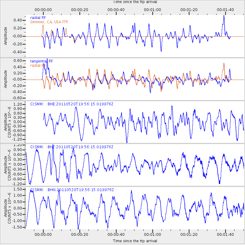
SMM Simmler, CA, USA - Earthquake Result Viewer
*The percent match for this event was below the threshold and hence no stack was calculated.
| Earthquake location: |
Eastern New Guinea Reg., P.N.G. |
| Earthquake latitude/longitude: |
-7.2/146.9 |
| Earthquake time(UTC): |
2011/05/20 (140) 19:43:16 GMT |
| Earthquake Depth: |
7.0 km |
| Earthquake Magnitude: |
6.2 MB, 5.5 MS, 5.7 MW, 5.7 MW |
| Earthquake Catalog/Contributor: |
WHDF/NEIC |
|
| Network: |
CI Caltech Regional Seismic Network |
| Station: |
SMM Simmler, CA, USA |
| Lat/Lon: |
35.31 N/120.00 W |
| Elevation: |
599 m |
|
| Distance: |
96.6 deg |
| Az: |
55.297 deg |
| Baz: |
265.908 deg |
| Ray Param: |
$rayparam |
*The percent match for this event was below the threshold and hence was not used in the summary stack. |
|
| Radial Match: |
57.444794 % |
| Radial Bump: |
400 |
| Transverse Match: |
55.272964 % |
| Transverse Bump: |
400 |
| SOD ConfigId: |
391883 |
| Insert Time: |
2011-10-23 01:14:36.121 +0000 |
| GWidth: |
2.5 |
| Max Bumps: |
400 |
| Tol: |
0.001 |
|
Signal To Noise
| Channel | StoN | STA | LTA |
| CI:SMM: :BHZ:20110520T19:56:15.019976Z | 1.2868915 | 6.279526E-7 | 4.879608E-7 |
| CI:SMM: :BHN:20110520T19:56:15.019976Z | 0.9025166 | 6.2210484E-7 | 6.893001E-7 |
| CI:SMM: :BHE:20110520T19:56:15.019976Z | 0.95103276 | 4.7294358E-7 | 4.972947E-7 |
| Arrivals |
| Ps | |
| PpPs | |
| PsPs/PpSs | |


