You are here: Home > Network List > TA - USArray Transportable Network (new EarthScope stations) Stations List
> Station J01D Myrtle Point, OR, USA > Earthquake Result Viewer
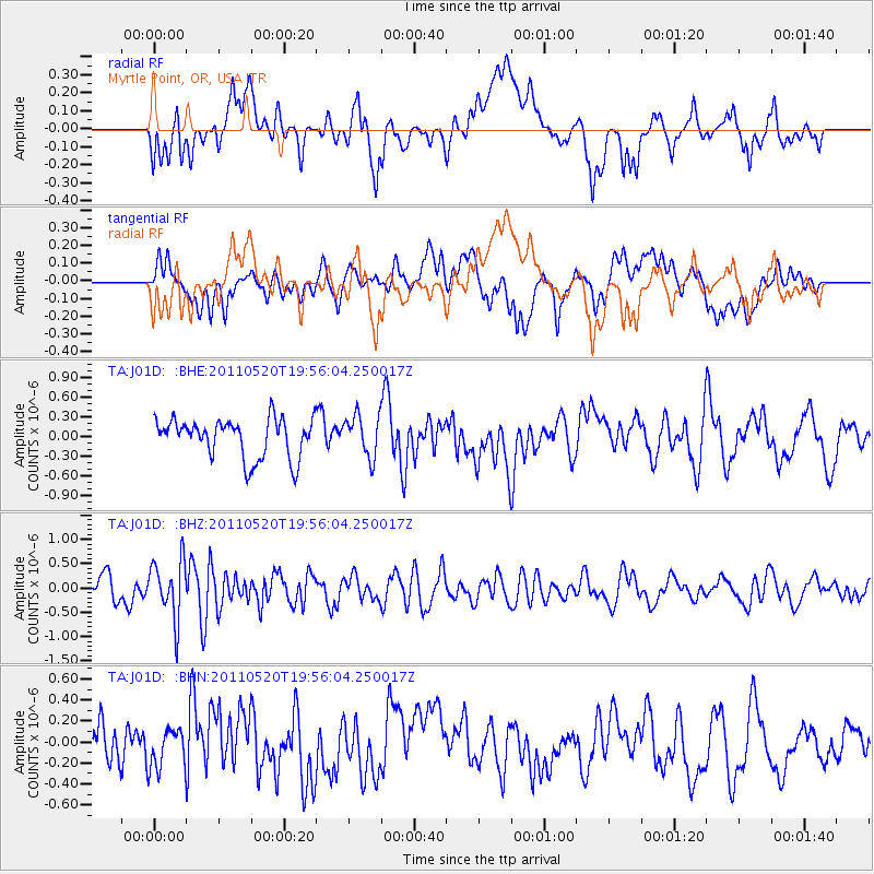
J01D Myrtle Point, OR, USA - Earthquake Result Viewer
*The percent match for this event was below the threshold and hence no stack was calculated.
| Earthquake location: |
Eastern New Guinea Reg., P.N.G. |
| Earthquake latitude/longitude: |
-7.2/146.9 |
| Earthquake time(UTC): |
2011/05/20 (140) 19:43:16 GMT |
| Earthquake Depth: |
7.0 km |
| Earthquake Magnitude: |
6.2 MB, 5.5 MS, 5.7 MW, 5.7 MW |
| Earthquake Catalog/Contributor: |
WHDF/NEIC |
|
| Network: |
TA USArray Transportable Network (new EarthScope stations) |
| Station: |
J01D Myrtle Point, OR, USA |
| Lat/Lon: |
43.16 N/123.93 W |
| Elevation: |
131 m |
|
| Distance: |
94.3 deg |
| Az: |
47.194 deg |
| Baz: |
264.192 deg |
| Ray Param: |
$rayparam |
*The percent match for this event was below the threshold and hence was not used in the summary stack. |
|
| Radial Match: |
52.987854 % |
| Radial Bump: |
400 |
| Transverse Match: |
56.551197 % |
| Transverse Bump: |
400 |
| SOD ConfigId: |
391883 |
| Insert Time: |
2011-10-23 01:19:56.271 +0000 |
| GWidth: |
2.5 |
| Max Bumps: |
400 |
| Tol: |
0.001 |
|
Signal To Noise
| Channel | StoN | STA | LTA |
| TA:J01D: :BHZ:20110520T19:56:04.250017Z | 1.842689 | 6.041538E-7 | 3.2786528E-7 |
| TA:J01D: :BHN:20110520T19:56:04.250017Z | 0.8451105 | 1.8363353E-7 | 2.1728937E-7 |
| TA:J01D: :BHE:20110520T19:56:04.250017Z | 1.0766205 | 3.220194E-7 | 2.9910208E-7 |
| Arrivals |
| Ps | |
| PpPs | |
| PsPs/PpSs | |


