
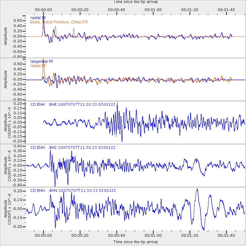
ENH Enshi, Hubei Province, China - Earthquake Result Viewer
| ||||||||||||||||||
| ||||||||||||||||||
| ||||||||||||||||||
|
Signal To Noise
| Channel | StoN | STA | LTA |
| CD:ENH: :BHZ:19970707T11:30:23.620013Z | 4.487822 | 9.462143E-8 | 2.1084041E-8 |
| CD:ENH: :BHN:19970707T11:30:23.620013Z | 2.1959145 | 5.107827E-8 | 2.326059E-8 |
| CD:ENH: :BHE:19970707T11:30:23.620013Z | 2.1311498 | 4.100817E-8 | 1.9242275E-8 |
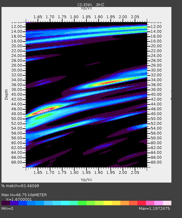
| Arrivals | |
| Ps | 5.6 SECOND |
| PpPs | 19 SECOND |
| PsPs/PpSs | 25 SECOND |

