You are here: Home > Network List > TA - USArray Transportable Network (new EarthScope stations) Stations List
> Station E28A Huff, ND, USA > Earthquake Result Viewer
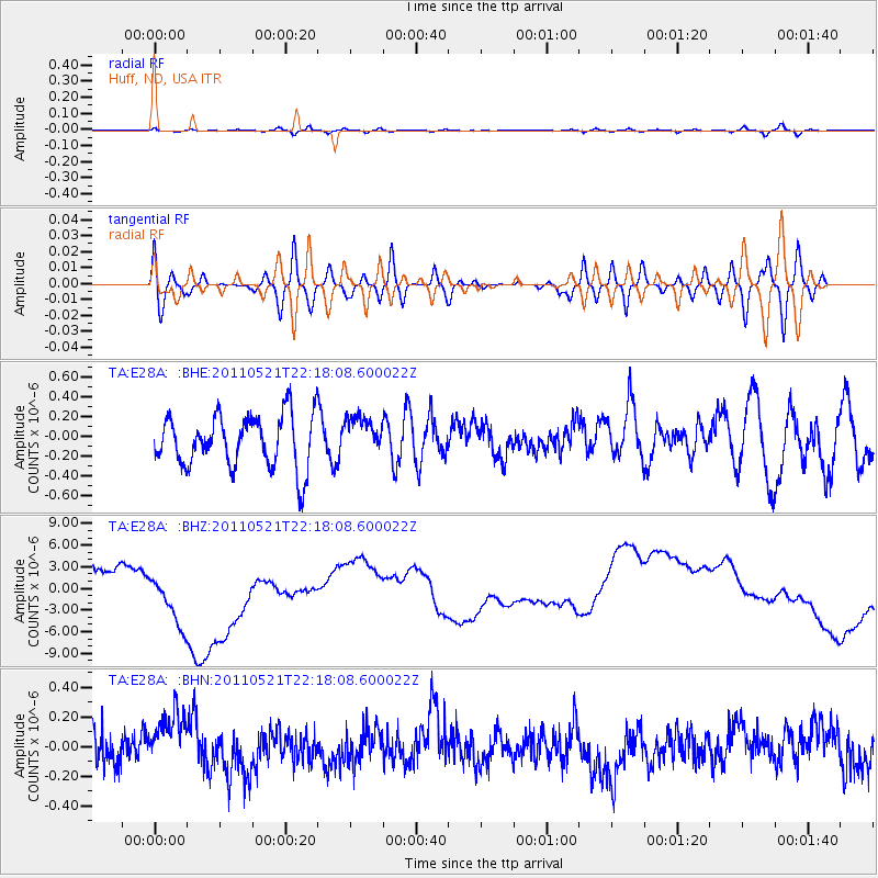
E28A Huff, ND, USA - Earthquake Result Viewer
*The percent match for this event was below the threshold and hence no stack was calculated.
| Earthquake location: |
Near East Coast Of Honshu, Japan |
| Earthquake latitude/longitude: |
35.6/140.5 |
| Earthquake time(UTC): |
2011/05/21 (141) 22:06:26 GMT |
| Earthquake Depth: |
37 km |
| Earthquake Magnitude: |
5.5 MB, 5.0 MS, 5.5 MW, 5.6 MW |
| Earthquake Catalog/Contributor: |
WHDF/NEIC |
|
| Network: |
TA USArray Transportable Network (new EarthScope stations) |
| Station: |
E28A Huff, ND, USA |
| Lat/Lon: |
46.57 N/100.69 W |
| Elevation: |
579 m |
|
| Distance: |
81.5 deg |
| Az: |
37.677 deg |
| Baz: |
313.773 deg |
| Ray Param: |
$rayparam |
*The percent match for this event was below the threshold and hence was not used in the summary stack. |
|
| Radial Match: |
54.11217 % |
| Radial Bump: |
400 |
| Transverse Match: |
49.913628 % |
| Transverse Bump: |
400 |
| SOD ConfigId: |
393008 |
| Insert Time: |
2011-10-28 08:23:09.189 +0000 |
| GWidth: |
2.5 |
| Max Bumps: |
400 |
| Tol: |
0.001 |
|
Signal To Noise
| Channel | StoN | STA | LTA |
| TA:E28A: :BHZ:20110521T22:18:08.600022Z | 2.1635454 | 6.8155123E-6 | 3.1501593E-6 |
| TA:E28A: :BHN:20110521T22:18:08.600022Z | 1.6219728 | 1.971297E-7 | 1.21537E-7 |
| TA:E28A: :BHE:20110521T22:18:08.600022Z | 0.73420334 | 1.9441718E-7 | 2.6480018E-7 |
| Arrivals |
| Ps | |
| PpPs | |
| PsPs/PpSs | |


