You are here: Home > Network List > TA - USArray Transportable Network (new EarthScope stations) Stations List
> Station Y40A Okolona, AR, USA > Earthquake Result Viewer
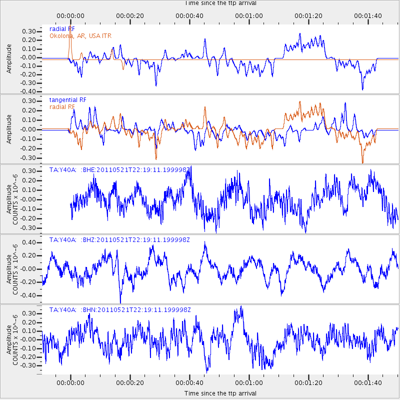
Y40A Okolona, AR, USA - Earthquake Result Viewer
*The percent match for this event was below the threshold and hence no stack was calculated.
| Earthquake location: |
Near East Coast Of Honshu, Japan |
| Earthquake latitude/longitude: |
35.6/140.5 |
| Earthquake time(UTC): |
2011/05/21 (141) 22:06:26 GMT |
| Earthquake Depth: |
37 km |
| Earthquake Magnitude: |
5.5 MB, 5.0 MS, 5.5 MW, 5.6 MW |
| Earthquake Catalog/Contributor: |
WHDF/NEIC |
|
| Network: |
TA USArray Transportable Network (new EarthScope stations) |
| Station: |
Y40A Okolona, AR, USA |
| Lat/Lon: |
34.01 N/93.28 W |
| Elevation: |
117 m |
|
| Distance: |
94.4 deg |
| Az: |
42.228 deg |
| Baz: |
318.746 deg |
| Ray Param: |
$rayparam |
*The percent match for this event was below the threshold and hence was not used in the summary stack. |
|
| Radial Match: |
54.53633 % |
| Radial Bump: |
400 |
| Transverse Match: |
66.88479 % |
| Transverse Bump: |
400 |
| SOD ConfigId: |
393008 |
| Insert Time: |
2011-10-28 08:31:28.448 +0000 |
| GWidth: |
2.5 |
| Max Bumps: |
400 |
| Tol: |
0.001 |
|
Signal To Noise
| Channel | StoN | STA | LTA |
| TA:Y40A: :BHZ:20110521T22:19:11.199998Z | 1.2549832 | 1.2695959E-7 | 1.01164375E-7 |
| TA:Y40A: :BHN:20110521T22:19:11.199998Z | 1.0304915 | 1.2408272E-7 | 1.2041122E-7 |
| TA:Y40A: :BHE:20110521T22:19:11.199998Z | 1.2120442 | 1.067738E-7 | 8.809398E-8 |
| Arrivals |
| Ps | |
| PpPs | |
| PsPs/PpSs | |


