You are here: Home > Network List > TA - USArray Transportable Network (new EarthScope stations) Stations List
> Station J04D Umpqua National Forest, Toketee, OR, USA > Earthquake Result Viewer
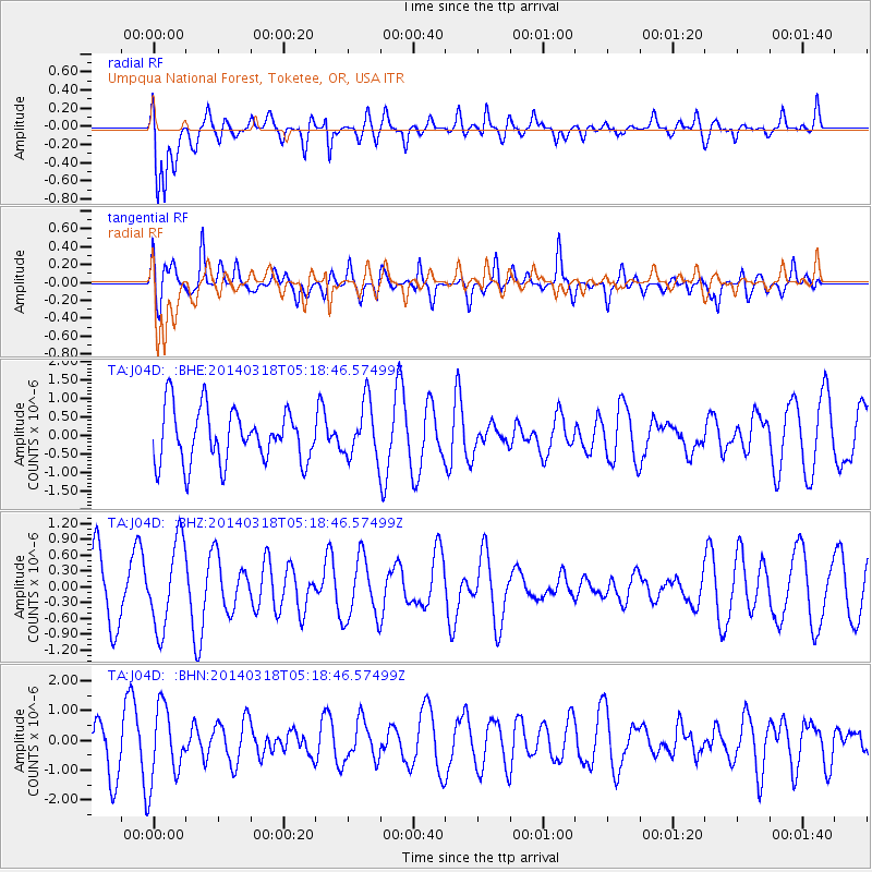
J04D Umpqua National Forest, Toketee, OR, USA - Earthquake Result Viewer
*The percent match for this event was below the threshold and hence no stack was calculated.
| Earthquake location: |
New Britain Region, P.N.G. |
| Earthquake latitude/longitude: |
-5.4/153.0 |
| Earthquake time(UTC): |
2014/03/18 (077) 05:06:22 GMT |
| Earthquake Depth: |
37 km |
| Earthquake Magnitude: |
5.2 MW |
| Earthquake Catalog/Contributor: |
ISC/ISC |
|
| Network: |
TA USArray Transportable Network (new EarthScope stations) |
| Station: |
J04D Umpqua National Forest, Toketee, OR, USA |
| Lat/Lon: |
43.24 N/122.11 W |
| Elevation: |
1948 m |
|
| Distance: |
90.0 deg |
| Az: |
46.71 deg |
| Baz: |
262.581 deg |
| Ray Param: |
$rayparam |
*The percent match for this event was below the threshold and hence was not used in the summary stack. |
|
| Radial Match: |
67.82113 % |
| Radial Bump: |
400 |
| Transverse Match: |
53.616493 % |
| Transverse Bump: |
400 |
| SOD ConfigId: |
3390531 |
| Insert Time: |
2019-04-10 17:55:18.052 +0000 |
| GWidth: |
2.5 |
| Max Bumps: |
400 |
| Tol: |
0.001 |
|
Signal To Noise
| Channel | StoN | STA | LTA |
| TA:J04D: :BHZ:20140318T05:18:46.57499Z | 1.8581641 | 8.172933E-7 | 4.3983914E-7 |
| TA:J04D: :BHN:20140318T05:18:46.57499Z | 2.1967134 | 1.2428158E-6 | 5.657614E-7 |
| TA:J04D: :BHE:20140318T05:18:46.57499Z | 1.0585412 | 7.5593084E-7 | 7.141251E-7 |
| Arrivals |
| Ps | |
| PpPs | |
| PsPs/PpSs | |


